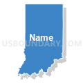
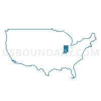
Indiana
About
Outline

Summary
| Unique Area Identifier | 201777 |
| Name | Indiana |
| Area (square miles) | 36,419.55 |
| Land Area (square miles) | 35,826.11 |
| Water Area (square miles) | 593.44 |
| % of Land Area | 98.37 |
| % of Water Area | 1.63 |
| Latitude of the Internal Point | 39.90302560 |
| Longtitude of the Internal Point | -86.28395030 |
| Total Population | 6,483,802 |
| Total Housing Units | 2,795,541 |
| Total Households | 2,502,154 |
| Median Age | 37 |
Maps
Graphs
Select a template below for downloading or customizing gragh for Indiana


Neighbors
Neighoring State and Equivalent (by Name) Neighboring State and Equivalent on the Map
County in Indiana (by Name) Neighboring County on the Map
- Adams County, IN
- Allen County, IN
- Bartholomew County, IN
- Benton County, IN
- Blackford County, IN
- Boone County, IN
- Brown County, IN
- Carroll County, IN
- Cass County, IN
- Clark County, IN
- Clay County, IN
- Clinton County, IN
- Crawford County, IN
- Daviess County, IN
- Dearborn County, IN
- Decatur County, IN
- DeKalb County, IN
- Delaware County, IN
- Dubois County, IN
- Elkhart County, IN
- Fayette County, IN
- Floyd County, IN
- Fountain County, IN
- Franklin County, IN
- Fulton County, IN
- Gibson County, IN
- Grant County, IN
- Greene County, IN
- Hamilton County, IN
- Hancock County, IN
- Harrison County, IN
- Hendricks County, IN
- Henry County, IN
- Howard County, IN
- Huntington County, IN
- Jackson County, IN
- Jasper County, IN
- Jay County, IN
- Jefferson County, IN
- Jennings County, IN
- Johnson County, IN
- Knox County, IN
- Kosciusko County, IN
- LaGrange County, IN
- Lake County, IN
- LaPorte County, IN
- Lawrence County, IN
- Madison County, IN
- Marion County, IN
- Marshall County, IN
- Martin County, IN
- Miami County, IN
- Monroe County, IN
- Montgomery County, IN
- Morgan County, IN
- Newton County, IN
- Noble County, IN
- Ohio County, IN
- Orange County, IN
- Owen County, IN
- Parke County, IN
- Perry County, IN
- Pike County, IN
- Porter County, IN
- Posey County, IN
- Pulaski County, IN
- Putnam County, IN
- Randolph County, IN
- Ripley County, IN
- Rush County, IN
- Scott County, IN
- Shelby County, IN
- Spencer County, IN
- St. Joseph County, IN
- Starke County, IN
- Steuben County, IN
- Sullivan County, IN
- Switzerland County, IN
- Tippecanoe County, IN
- Tipton County, IN
- Union County, IN
- Vanderburgh County, IN
- Vermillion County, IN
- Vigo County, IN
- Wabash County, IN
- Warren County, IN
- Warrick County, IN
- Washington County, IN
- Wayne County, IN
- Wells County, IN
- White County, IN
- Whitley County, IN
Top 10 County Subdivision in Indiana (by Population) Neighboring County Subdivision on the Map
- North township, Lake County, IN (162,855)
- Center township, Marion County, IN (142,787)
- Wayne township, Marion County, IN (136,828)
- Washington township, Marion County, IN (132,049)
- Lawrence township, Marion County, IN (118,447)
- Perry township, Marion County, IN (108,972)
- Calumet township, Lake County, IN (104,258)
- Wayne township, Allen County, IN (103,803)
- Warren township, Marion County, IN (99,433)
- Portage township, St. Joseph County, IN (93,063)
Top 10 Place in Indiana (by Population) Neighboring Place on the Map
- Indianapolis city (balance), IN (820,445)
- Fort Wayne city, IN (253,691)
- Evansville city, IN (117,429)
- South Bend city, IN (101,168)
- Hammond city, IN (80,830)
- Bloomington city, IN (80,405)
- Gary city, IN (80,294)
- Carmel city, IN (79,191)
- Fishers town, IN (76,794)
- Muncie city, IN (70,085)
Top 10 Unified School District in Indiana (by Population) Neighboring Unified School District on the Map
- Indianapolis Public Schools, IN (296,715)
- Fort Wayne Community Schools, IN (215,527)
- Evansville-Vanderburgh School Corporation, IN (179,703)
- South Bend Community School Corporation, IN (160,103)
- Monroe County Community School Corporation, IN (120,715)
- Vigo County School Corporation, IN (107,848)
- Lawrence Township Metropolitan School District, IN (95,614)
- Perry Township Metropolitan School District, IN (93,918)
- Hamilton Southeastern Schools, IN (90,116)
- Tippecanoe School Corporation, IN (89,548)
Top 10 State Legislative District Lower Chamber in Indiana (by Population) Neighboring State Legislative District Lower Chamber on the Map
- State House District 29, IN (118,413)
- State House District 40, IN (94,412)
- State House District 90, IN (87,489)
- State House District 87, IN (80,568)
- State House District 58, IN (79,869)
- State House District 85, IN (78,990)
- State House District 93, IN (78,464)
- State House District 78, IN (77,639)
- State House District 26, IN (76,639)
- State House District 39, IN (76,305)
Top 10 State Legislative District Upper Chamber in Indiana (by Population) Neighboring State Legislative District Upper Chamber on the Map
- State Senate District 28, IN (171,077)
- State Senate District 24, IN (162,120)
- State Senate District 32, IN (158,509)
- State Senate District 20, IN (148,100)
- State Senate District 6, IN (146,652)
- State Senate District 22, IN (144,531)
- State Senate District 29, IN (142,253)
- State Senate District 21, IN (141,992)
- State Senate District 4, IN (141,328)
- State Senate District 40, IN (139,764)
Top 10 111th Congressional District in Indiana (by Population) Neighboring 111th Congressional District on the Map
- Congressional District 5, IN (809,107)
- Congressional District 4, IN (789,835)
- Congressional District 9, IN (729,076)
- Congressional District 3, IN (723,633)
- Congressional District 1, IN (705,600)
- Congressional District 8, IN (694,398)
- Congressional District 2, IN (679,254)
- Congressional District 6, IN (676,548)
- Congressional District 7, IN (676,351)
Top 10 Census Tract in Indiana (by Population) Neighboring Census Tract on the Map
- Census Tract 1108.08, Hamilton County, IN (18,793)
- Census Tract 3801, Marion County, IN (16,494)
- Census Tract 2101.02, Hendricks County, IN (16,246)
- Census Tract 2106.04, Hendricks County, IN (13,568)
- Census Tract 6101, Johnson County, IN (13,386)
- Census Tract 3904.02, Marion County, IN (12,696)
- Census Tract 1108.06, Hamilton County, IN (12,465)
- Census Tract 1108.04, Hamilton County, IN (12,353)
- Census Tract 102.04, Tippecanoe County, IN (12,230)
- Census Tract 1103, Hamilton County, IN (12,100)
Top 10 5-Digit ZIP Code Tabulation Area in Indiana (by Population) Neighboring 5-Digit ZIP Code Tabulation Area on the Map
- 47906, IN (66,972)
- 46307, IN (60,619)
- 46227, IN (57,086)
- 46143, IN (48,555)
- 47150, IN (47,472)
- 47374, IN (46,875)
- 47130, IN (44,722)
- 46226, IN (43,904)
- 46350, IN (43,650)
- 46360, IN (43,625)
Data
Demographic, Population, Households, and Housing Units
** Data sources from census 2010 **
Show Data on Map
Download Full List as CSV
Download Quick Sheet as CSV
| Subject | This Area | National |
|---|---|---|
| POPULATION | ||
| Total Population Map | 6,483,802 | 308,745,538 |
| POPULATION, HISPANIC OR LATINO ORIGIN | ||
| Not Hispanic or Latino Map | 6,094,095 | 258,267,944 |
| Hispanic or Latino Map | 389,707 | 50,477,594 |
| POPULATION, RACE | ||
| White alone Map | 5,467,906 | 223,553,265 |
| Black or African American alone Map | 591,397 | 38,929,319 |
| American Indian and Alaska Native alone Map | 18,462 | 2,932,248 |
| Asian alone Map | 102,474 | 14,674,252 |
| Native Hawaiian and Other Pacific Islander alone Map | 2,348 | 540,013 |
| Some Other Race alone Map | 173,314 | 19,107,368 |
| Two or More Races Map | 127,901 | 9,009,073 |
| POPULATION, SEX | ||
| Male Map | 3,189,737 | 151,781,326 |
| Female Map | 3,294,065 | 156,964,212 |
| POPULATION, AGE (18 YEARS) | ||
| 18 years and over Map | 4,875,504 | 234,564,071 |
| Under 18 years | 1,608,298 | 74,181,467 |
| POPULATION, AGE | ||
| Under 5 years | 434,075 | 20,201,362 |
| 5 to 9 years | 444,821 | 20,348,657 |
| 10 to 14 years | 452,171 | 20,677,194 |
| 15 to 17 years | 277,231 | 12,954,254 |
| 18 and 19 years | 198,284 | 9,086,089 |
| 20 years | 98,994 | 4,519,129 |
| 21 years | 94,313 | 4,354,294 |
| 22 to 24 years | 258,719 | 12,712,576 |
| 25 to 29 years | 419,530 | 21,101,849 |
| 30 to 34 years | 407,815 | 19,962,099 |
| 35 to 39 years | 417,011 | 20,179,642 |
| 40 to 44 years | 423,819 | 20,890,964 |
| 45 to 49 years | 473,946 | 22,708,591 |
| 50 to 54 years | 472,822 | 22,298,125 |
| 55 to 59 years | 418,515 | 19,664,805 |
| 60 and 61 years | 150,022 | 7,113,727 |
| 62 to 64 years | 200,606 | 9,704,197 |
| 65 and 66 years | 109,710 | 5,319,902 |
| 67 to 69 years | 149,347 | 7,115,361 |
| 70 to 74 years | 193,278 | 9,278,166 |
| 75 to 79 years | 151,843 | 7,317,795 |
| 80 to 84 years | 121,658 | 5,743,327 |
| 85 years and over | 115,272 | 5,493,433 |
| MEDIAN AGE BY SEX | ||
| Both sexes Map | 37.00 | 37.20 |
| Male Map | 35.70 | 35.80 |
| Female Map | 38.20 | 38.50 |
| HOUSEHOLDS | ||
| Total Households Map | 2,502,154 | 116,716,292 |
| HOUSEHOLDS, HOUSEHOLD TYPE | ||
| Family households: Map | 1,674,126 | 77,538,296 |
| Husband-wife family Map | 1,241,267 | 56,510,377 |
| Other family: Map | 432,859 | 21,027,919 |
| Male householder, no wife present Map | 122,677 | 5,777,570 |
| Female householder, no husband present Map | 310,182 | 15,250,349 |
| Nonfamily households: Map | 828,028 | 39,177,996 |
| Householder living alone Map | 671,920 | 31,204,909 |
| Householder not living alone Map | 156,108 | 7,973,087 |
| HOUSEHOLDS, HISPANIC OR LATINO ORIGIN OF HOUSEHOLDER | ||
| Not Hispanic or Latino householder: Map | 2,403,018 | 103,254,926 |
| Hispanic or Latino householder: Map | 99,136 | 13,461,366 |
| HOUSEHOLDS, RACE OF HOUSEHOLDER | ||
| Householder who is White alone | 2,171,176 | 89,754,352 |
| Householder who is Black or African American alone | 220,246 | 14,129,983 |
| Householder who is American Indian and Alaska Native alone | 6,912 | 939,707 |
| Householder who is Asian alone | 32,567 | 4,632,164 |
| Householder who is Native Hawaiian and Other Pacific Islander alone | 688 | 143,932 |
| Householder who is Some Other Race alone | 43,842 | 4,916,427 |
| Householder who is Two or More Races | 26,723 | 2,199,727 |
| HOUSEHOLDS, HOUSEHOLD TYPE BY HOUSEHOLD SIZE | ||
| Family households: Map | 1,674,126 | 77,538,296 |
| 2-person household Map | 729,444 | 31,882,616 |
| 3-person household Map | 378,922 | 17,765,829 |
| 4-person household Map | 318,738 | 15,214,075 |
| 5-person household Map | 153,042 | 7,411,997 |
| 6-person household Map | 58,414 | 3,026,278 |
| 7-or-more-person household Map | 35,566 | 2,237,501 |
| Nonfamily households: Map | 828,028 | 39,177,996 |
| 1-person household Map | 671,920 | 31,204,909 |
| 2-person household Map | 124,749 | 6,360,012 |
| 3-person household Map | 19,544 | 992,156 |
| 4-person household Map | 8,255 | 411,171 |
| 5-person household Map | 2,393 | 126,634 |
| 6-person household Map | 737 | 48,421 |
| 7-or-more-person household Map | 430 | 34,693 |
| HOUSING UNITS | ||
| Total Housing Units Map | 2,795,541 | 131,704,730 |
| HOUSING UNITS, OCCUPANCY STATUS | ||
| Occupied Map | 2,502,154 | 116,716,292 |
| Vacant Map | 293,387 | 14,988,438 |
| HOUSING UNITS, OCCUPIED, TENURE | ||
| Owned with a mortgage or a loan Map | 1,259,825 | 52,979,430 |
| Owned free and clear Map | 488,150 | 23,006,644 |
| Renter occupied Map | 754,179 | 40,730,218 |
| HOUSING UNITS, VACANT, VACANCY STATUS | ||
| For rent Map | 93,029 | 4,137,567 |
| Rented, not occupied Map | 3,859 | 206,825 |
| For sale only Map | 46,410 | 1,896,796 |
| Sold, not occupied Map | 10,862 | 421,032 |
| For seasonal, recreational, or occasional use Map | 45,571 | 4,649,298 |
| For migrant workers Map | 200 | 24,161 |
| Other vacant Map | 93,456 | 3,652,759 |
| HOUSING UNITS, OCCUPIED, AVERAGE HOUSEHOLD SIZE BY TENURE | ||
| Total: Map | 2.52 | 2.58 |
| Owner occupied Map | 2.60 | 2.65 |
| Renter occupied Map | 2.33 | 2.44 |
| HOUSING UNITS, OCCUPIED, TENURE BY RACE OF HOUSEHOLDER | ||
| Owner occupied: Map | 1,747,975 | 75,986,074 |
| Householder who is White alone Map | 1,604,197 | 63,446,275 |
| Householder who is Black or African American alone Map | 89,346 | 6,261,464 |
| Householder who is American Indian and Alaska Native alone Map | 3,927 | 509,588 |
| Householder who is Asian alone Map | 16,499 | 2,688,861 |
| Householder who is Native Hawaiian and Other Pacific Islander alone Map | 363 | 61,911 |
| Householder who is Some Other Race alone Map | 20,395 | 1,975,817 |
| Householder who is Two or More Races Map | 13,248 | 1,042,158 |
| Renter occupied: Map | 754,179 | 40,730,218 |
| Householder who is White alone Map | 566,979 | 26,308,077 |
| Householder who is Black or African American alone Map | 130,900 | 7,868,519 |
| Householder who is American Indian and Alaska Native alone Map | 2,985 | 430,119 |
| Householder who is Asian alone Map | 16,068 | 1,943,303 |
| Householder who is Native Hawaiian and Other Pacific Islander alone Map | 325 | 82,021 |
| Householder who is Some Other Race alone Map | 23,447 | 2,940,610 |
| Householder who is Two or More Races Map | 13,475 | 1,157,569 |
| HOUSING UNITS, OCCUPIED, TENURE BY HISPANIC OR LATINO ORIGIN OF HOUSEHOLDER | ||
| Owner occupied: Map | 1,747,975 | 75,986,074 |
| Not Hispanic or Latino householder Map | 1,696,271 | 69,617,625 |
| Hispanic or Latino householder Map | 51,704 | 6,368,449 |
| Renter occupied: Map | 754,179 | 40,730,218 |
| Not Hispanic or Latino householder Map | 706,747 | 33,637,301 |
| Hispanic or Latino householder Map | 47,432 | 7,092,917 |
| HOUSING UNITS, OCCUPIED, TENURE BY HOUSEHOLD SIZE | ||
| Owner occupied: Map | 1,747,975 | 75,986,074 |
| 1-person household Map | 379,164 | 16,453,569 |
| 2-person household Map | 659,731 | 27,618,605 |
| 3-person household Map | 283,901 | 12,517,563 |
| 4-person household Map | 245,272 | 10,998,793 |
| 5-person household Map | 113,305 | 5,057,765 |
| 6-person household Map | 41,703 | 1,965,796 |
| 7-or-more-person household Map | 24,899 | 1,373,983 |
| Renter occupied: Map | 754,179 | 40,730,218 |
| 1-person household Map | 292,756 | 14,751,340 |
| 2-person household Map | 194,462 | 10,624,023 |
| 3-person household Map | 114,565 | 6,240,422 |
| 4-person household Map | 81,721 | 4,626,453 |
| 5-person household Map | 42,130 | 2,480,866 |
| 6-person household Map | 17,448 | 1,108,903 |
| 7-or-more-person household Map | 11,097 | 898,211 |
Loading...


