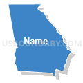
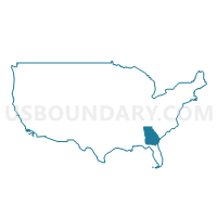
Georgia
About
Outline

Summary
| Unique Area Identifier | 201747 |
| Name | Georgia |
| Area (square miles) | 59,425.15 |
| Land Area (square miles) | 57,513.48 |
| Water Area (square miles) | 1,911.67 |
| % of Land Area | 96.78 |
| % of Water Area | 3.22 |
| Latitude of the Internal Point | 32.62938400 |
| Longtitude of the Internal Point | -83.42321250 |
| Total Population | 9,687,653 |
| Total Housing Units | 4,088,801 |
| Total Households | 3,585,584 |
| Median Age | 35.3 |
Maps
Graphs
Select a template below for downloading or customizing gragh for Georgia


Neighbors
Neighoring State and Equivalent (by Name) Neighboring State and Equivalent on the Map
County in Georgia (by Name) Neighboring County on the Map
- Appling County, GA
- Atkinson County, GA
- Bacon County, GA
- Baker County, GA
- Baldwin County, GA
- Banks County, GA
- Barrow County, GA
- Bartow County, GA
- Ben Hill County, GA
- Berrien County, GA
- Bibb County, GA
- Bleckley County, GA
- Brantley County, GA
- Brooks County, GA
- Bryan County, GA
- Bulloch County, GA
- Burke County, GA
- Butts County, GA
- Calhoun County, GA
- Camden County, GA
- Candler County, GA
- Carroll County, GA
- Catoosa County, GA
- Charlton County, GA
- Chatham County, GA
- Chattahoochee County, GA
- Chattooga County, GA
- Cherokee County, GA
- Clarke County, GA
- Clay County, GA
- Clayton County, GA
- Clinch County, GA
- Cobb County, GA
- Coffee County, GA
- Colquitt County, GA
- Columbia County, GA
- Cook County, GA
- Coweta County, GA
- Crawford County, GA
- Crisp County, GA
- Dade County, GA
- Dawson County, GA
- Decatur County, GA
- DeKalb County, GA
- Dodge County, GA
- Dooly County, GA
- Dougherty County, GA
- Douglas County, GA
- Early County, GA
- Echols County, GA
- Effingham County, GA
- Elbert County, GA
- Emanuel County, GA
- Evans County, GA
- Fannin County, GA
- Fayette County, GA
- Floyd County, GA
- Forsyth County, GA
- Franklin County, GA
- Fulton County, GA
- Gilmer County, GA
- Glascock County, GA
- Glynn County, GA
- Gordon County, GA
- Grady County, GA
- Greene County, GA
- Gwinnett County, GA
- Habersham County, GA
- Hall County, GA
- Hancock County, GA
- Haralson County, GA
- Harris County, GA
- Hart County, GA
- Heard County, GA
- Henry County, GA
- Houston County, GA
- Irwin County, GA
- Jackson County, GA
- Jasper County, GA
- Jeff Davis County, GA
- Jefferson County, GA
- Jenkins County, GA
- Johnson County, GA
- Jones County, GA
- Lamar County, GA
- Lanier County, GA
- Laurens County, GA
- Lee County, GA
- Liberty County, GA
- Lincoln County, GA
- Long County, GA
- Lowndes County, GA
- Lumpkin County, GA
- Macon County, GA
- Madison County, GA
- Marion County, GA
- McDuffie County, GA
- McIntosh County, GA
- Meriwether County, GA
- Miller County, GA
- Mitchell County, GA
- Monroe County, GA
- Montgomery County, GA
- Morgan County, GA
- Murray County, GA
- Muscogee County, GA
- Newton County, GA
- Oconee County, GA
- Oglethorpe County, GA
- Paulding County, GA
- Peach County, GA
- Pickens County, GA
- Pierce County, GA
- Pike County, GA
- Polk County, GA
- Pulaski County, GA
- Putnam County, GA
- Quitman County, GA
- Rabun County, GA
- Randolph County, GA
- Richmond County, GA
- Rockdale County, GA
- Schley County, GA
- Screven County, GA
- Seminole County, GA
- Spalding County, GA
- Stephens County, GA
- Stewart County, GA
- Sumter County, GA
- Talbot County, GA
- Taliaferro County, GA
- Tattnall County, GA
- Taylor County, GA
- Telfair County, GA
- Terrell County, GA
- Thomas County, GA
- Tift County, GA
- Toombs County, GA
- Towns County, GA
- Treutlen County, GA
- Troup County, GA
- Turner County, GA
- Twiggs County, GA
- Union County, GA
- Upson County, GA
- Walker County, GA
- Walton County, GA
- Ware County, GA
- Warren County, GA
- Washington County, GA
- Wayne County, GA
- Webster County, GA
- Wheeler County, GA
- White County, GA
- Whitfield County, GA
- Wilcox County, GA
- Wilkes County, GA
- Wilkinson County, GA
- Worth County, GA
Top 10 County Subdivision in Georgia (by Population) Neighboring County Subdivision on the Map
- Atlanta CCD, Fulton County, GA (531,648)
- Atlanta-Decatur CCD, DeKalb County, GA (355,979)
- Roswell-Alpharetta CCD, Fulton County, GA (255,812)
- Lawrenceville CCD, Gwinnett County, GA (215,169)
- Acworth-Kennesaw CCD, Cobb County, GA (178,291)
- Northeast Cobb CCD, Cobb County, GA (152,795)
- Savannah CCD, Chatham County, GA (151,833)
- Snellville-Grayson CCD, Gwinnett County, GA (148,651)
- Chamblee-Doraville CCD, DeKalb County, GA (137,880)
- Augusta CCD, Richmond County, GA (134,777)
Top 10 Place in Georgia (by Population) Neighboring Place on the Map
- Atlanta city, GA (420,003)
- Augusta-Richmond County consolidated government (balance), GA (195,844)
- Columbus city, GA (189,885)
- Savannah city, GA (136,286)
- Athens-Clarke County unified government (balance), GA (115,452)
- Sandy Springs city, GA (93,853)
- Macon city, GA (91,351)
- Roswell city, GA (88,346)
- Albany city, GA (77,434)
- Johns Creek city, GA (76,728)
Top 10 Elementary School District in Georgia (by Population) Neighboring Elementary School District on the Map
Top 10 Secondary School District in Georgia (by Population) Neighboring Secondary School District on the Map
Top 10 Unified School District in Georgia (by Population) Neighboring Unified School District on the Map
- Gwinnett County School District, GA (793,941)
- DeKalb County School District, GA (644,266)
- Cobb County School District, GA (631,499)
- Fulton County School District, GA (528,870)
- Atlanta City School District, GA (420,003)
- Chatham County School District, GA (265,128)
- Clayton County School District, GA (259,424)
- Cherokee County School District, GA (214,346)
- Henry County School District, GA (203,922)
- Richmond County School District, GA (200,549)
Top 10 State Legislative District Lower Chamber in Georgia (by Population) Neighboring State Legislative District Lower Chamber on the Map
- State House District 105, GA (91,944)
- State House District 107, GA (90,144)
- State House District 159, GA (88,115)
- State House District 98, GA (84,580)
- State House District 24, GA (80,448)
- State House District 110, GA (80,088)
- State House District 23, GA (79,982)
- State House District 17, GA (79,395)
- State House District 22, GA (78,834)
- State House District 109, GA (78,421)
Top 10 State Legislative District Upper Chamber in Georgia (by Population) Neighboring State Legislative District Upper Chamber on the Map
- State Senate District 27, GA (264,822)
- State Senate District 45, GA (256,939)
- State Senate District 17, GA (238,272)
- State Senate District 35, GA (214,483)
- State Senate District 30, GA (212,492)
- State Senate District 31, GA (204,694)
- State Senate District 9, GA (203,621)
- State Senate District 48, GA (198,933)
- State Senate District 47, GA (193,917)
- State Senate District 37, GA (192,546)
Top 10 111th Congressional District in Georgia (by Population) Neighboring 111th Congressional District on the Map
- Congressional District 7, GA (903,191)
- Congressional District 9, GA (823,583)
- Congressional District 3, GA (817,247)
- Congressional District 11, GA (794,969)
- Congressional District 13, GA (784,445)
- Congressional District 6, GA (767,798)
- Congressional District 10, GA (738,248)
- Congressional District 1, GA (722,068)
- Congressional District 8, GA (715,599)
- Congressional District 12, GA (692,529)
Top 10 Census Tract in Georgia (by Population) Neighboring Census Tract on the Map
- Census Tract 506.06, Gwinnett County, GA (20,655)
- Census Tract 907.01, Cherokee County, GA (19,523)
- Census Tract 211.13, Houston County, GA (17,841)
- Census Tract 1204, Paulding County, GA (17,016)
- Census Tract 107, Chatham County, GA (16,797)
- Census Tract 234.18, DeKalb County, GA (16,588)
- Census Tract 505.46, Gwinnett County, GA (16,073)
- Census Tract 507.24, Gwinnett County, GA (15,894)
- Census Tract 105.10, Fulton County, GA (15,841)
- Census Tract 506.08, Gwinnett County, GA (15,422)
Top 10 5-Digit ZIP Code Tabulation Area in Georgia (by Population) Neighboring 5-Digit ZIP Code Tabulation Area on the Map
- 30043, GA (80,241)
- 30044, GA (79,701)
- 30349, GA (67,602)
- 30281, GA (66,140)
- 30024, GA (64,614)
- 30022, GA (64,359)
- 30096, GA (62,265)
- 30062, GA (62,136)
- 30135, GA (61,912)
- 30127, GA (60,347)
Data
Demographic, Population, Households, and Housing Units
** Data sources from census 2010 **
Show Data on Map
Download Full List as CSV
Download Quick Sheet as CSV
| Subject | This Area | National |
|---|---|---|
| POPULATION | ||
| Total Population Map | 9,687,653 | 308,745,538 |
| POPULATION, HISPANIC OR LATINO ORIGIN | ||
| Not Hispanic or Latino Map | 8,833,964 | 258,267,944 |
| Hispanic or Latino Map | 853,689 | 50,477,594 |
| POPULATION, RACE | ||
| White alone Map | 5,787,440 | 223,553,265 |
| Black or African American alone Map | 2,950,435 | 38,929,319 |
| American Indian and Alaska Native alone Map | 32,151 | 2,932,248 |
| Asian alone Map | 314,467 | 14,674,252 |
| Native Hawaiian and Other Pacific Islander alone Map | 6,799 | 540,013 |
| Some Other Race alone Map | 388,872 | 19,107,368 |
| Two or More Races Map | 207,489 | 9,009,073 |
| POPULATION, SEX | ||
| Male Map | 4,729,171 | 151,781,326 |
| Female Map | 4,958,482 | 156,964,212 |
| POPULATION, AGE (18 YEARS) | ||
| 18 years and over Map | 7,196,101 | 234,564,071 |
| Under 18 years | 2,491,552 | 74,181,467 |
| POPULATION, AGE | ||
| Under 5 years | 686,785 | 20,201,362 |
| 5 to 9 years | 695,161 | 20,348,657 |
| 10 to 14 years | 689,684 | 20,677,194 |
| 15 to 17 years | 419,922 | 12,954,254 |
| 18 and 19 years | 290,077 | 9,086,089 |
| 20 years | 143,471 | 4,519,129 |
| 21 years | 137,251 | 4,354,294 |
| 22 to 24 years | 399,358 | 12,712,576 |
| 25 to 29 years | 673,935 | 21,101,849 |
| 30 to 34 years | 661,625 | 19,962,099 |
| 35 to 39 years | 698,059 | 20,179,642 |
| 40 to 44 years | 699,481 | 20,890,964 |
| 45 to 49 years | 722,661 | 22,708,591 |
| 50 to 54 years | 668,591 | 22,298,125 |
| 55 to 59 years | 573,551 | 19,664,805 |
| 60 and 61 years | 209,870 | 7,113,727 |
| 62 to 64 years | 286,136 | 9,704,197 |
| 65 and 66 years | 154,645 | 5,319,902 |
| 67 to 69 years | 201,362 | 7,115,361 |
| 70 to 74 years | 250,422 | 9,278,166 |
| 75 to 79 years | 182,735 | 7,317,795 |
| 80 to 84 years | 129,048 | 5,743,327 |
| 85 years and over | 113,823 | 5,493,433 |
| MEDIAN AGE BY SEX | ||
| Both sexes Map | 35.30 | 37.20 |
| Male Map | 34.10 | 35.80 |
| Female Map | 36.50 | 38.50 |
| HOUSEHOLDS | ||
| Total Households Map | 3,585,584 | 116,716,292 |
| HOUSEHOLDS, HOUSEHOLD TYPE | ||
| Family households: Map | 2,457,810 | 77,538,296 |
| Husband-wife family Map | 1,714,573 | 56,510,377 |
| Other family: Map | 743,237 | 21,027,919 |
| Male householder, no wife present Map | 175,090 | 5,777,570 |
| Female householder, no husband present Map | 568,147 | 15,250,349 |
| Nonfamily households: Map | 1,127,774 | 39,177,996 |
| Householder living alone Map | 909,474 | 31,204,909 |
| Householder not living alone Map | 218,300 | 7,973,087 |
| HOUSEHOLDS, HISPANIC OR LATINO ORIGIN OF HOUSEHOLDER | ||
| Not Hispanic or Latino householder: Map | 3,377,850 | 103,254,926 |
| Hispanic or Latino householder: Map | 207,734 | 13,461,366 |
| HOUSEHOLDS, RACE OF HOUSEHOLDER | ||
| Householder who is White alone | 2,270,546 | 89,754,352 |
| Householder who is Black or African American alone | 1,064,711 | 14,129,983 |
| Householder who is American Indian and Alaska Native alone | 10,909 | 939,707 |
| Householder who is Asian alone | 95,786 | 4,632,164 |
| Householder who is Native Hawaiian and Other Pacific Islander alone | 1,961 | 143,932 |
| Householder who is Some Other Race alone | 91,232 | 4,916,427 |
| Householder who is Two or More Races | 50,439 | 2,199,727 |
| HOUSEHOLDS, HOUSEHOLD TYPE BY HOUSEHOLD SIZE | ||
| Family households: Map | 2,457,810 | 77,538,296 |
| 2-person household Map | 957,729 | 31,882,616 |
| 3-person household Map | 592,787 | 17,765,829 |
| 4-person household Map | 503,595 | 15,214,075 |
| 5-person household Map | 240,456 | 7,411,997 |
| 6-person household Map | 96,811 | 3,026,278 |
| 7-or-more-person household Map | 66,432 | 2,237,501 |
| Nonfamily households: Map | 1,127,774 | 39,177,996 |
| 1-person household Map | 909,474 | 31,204,909 |
| 2-person household Map | 172,409 | 6,360,012 |
| 3-person household Map | 28,107 | 992,156 |
| 4-person household Map | 11,923 | 411,171 |
| 5-person household Map | 3,619 | 126,634 |
| 6-person household Map | 1,309 | 48,421 |
| 7-or-more-person household Map | 933 | 34,693 |
| HOUSING UNITS | ||
| Total Housing Units Map | 4,088,801 | 131,704,730 |
| HOUSING UNITS, OCCUPANCY STATUS | ||
| Occupied Map | 3,585,584 | 116,716,292 |
| Vacant Map | 503,217 | 14,988,438 |
| HOUSING UNITS, OCCUPIED, TENURE | ||
| Owned with a mortgage or a loan Map | 1,751,631 | 52,979,430 |
| Owned free and clear Map | 602,771 | 23,006,644 |
| Renter occupied Map | 1,231,182 | 40,730,218 |
| HOUSING UNITS, VACANT, VACANCY STATUS | ||
| For rent Map | 174,416 | 4,137,567 |
| Rented, not occupied Map | 6,792 | 206,825 |
| For sale only Map | 83,852 | 1,896,796 |
| Sold, not occupied Map | 13,118 | 421,032 |
| For seasonal, recreational, or occasional use Map | 81,511 | 4,649,298 |
| For migrant workers Map | 854 | 24,161 |
| Other vacant Map | 142,674 | 3,652,759 |
| HOUSING UNITS, OCCUPIED, AVERAGE HOUSEHOLD SIZE BY TENURE | ||
| Total: Map | 2.63 | 2.58 |
| Owner occupied Map | 2.67 | 2.65 |
| Renter occupied Map | 2.56 | 2.44 |
| HOUSING UNITS, OCCUPIED, TENURE BY RACE OF HOUSEHOLDER | ||
| Owner occupied: Map | 2,354,402 | 75,986,074 |
| Householder who is White alone Map | 1,691,212 | 63,446,275 |
| Householder who is Black or African American alone Map | 534,727 | 6,261,464 |
| Householder who is American Indian and Alaska Native alone Map | 5,889 | 509,588 |
| Householder who is Asian alone Map | 61,567 | 2,688,861 |
| Householder who is Native Hawaiian and Other Pacific Islander alone Map | 899 | 61,911 |
| Householder who is Some Other Race alone Map | 34,688 | 1,975,817 |
| Householder who is Two or More Races Map | 25,420 | 1,042,158 |
| Renter occupied: Map | 1,231,182 | 40,730,218 |
| Householder who is White alone Map | 579,334 | 26,308,077 |
| Householder who is Black or African American alone Map | 529,984 | 7,868,519 |
| Householder who is American Indian and Alaska Native alone Map | 5,020 | 430,119 |
| Householder who is Asian alone Map | 34,219 | 1,943,303 |
| Householder who is Native Hawaiian and Other Pacific Islander alone Map | 1,062 | 82,021 |
| Householder who is Some Other Race alone Map | 56,544 | 2,940,610 |
| Householder who is Two or More Races Map | 25,019 | 1,157,569 |
| HOUSING UNITS, OCCUPIED, TENURE BY HISPANIC OR LATINO ORIGIN OF HOUSEHOLDER | ||
| Owner occupied: Map | 2,354,402 | 75,986,074 |
| Not Hispanic or Latino householder Map | 2,262,073 | 69,617,625 |
| Hispanic or Latino householder Map | 92,329 | 6,368,449 |
| Renter occupied: Map | 1,231,182 | 40,730,218 |
| Not Hispanic or Latino householder Map | 1,115,777 | 33,637,301 |
| Hispanic or Latino householder Map | 115,405 | 7,092,917 |
| HOUSING UNITS, OCCUPIED, TENURE BY HOUSEHOLD SIZE | ||
| Owner occupied: Map | 2,354,402 | 75,986,074 |
| 1-person household Map | 498,417 | 16,453,569 |
| 2-person household Map | 821,066 | 27,618,605 |
| 3-person household Map | 417,477 | 12,517,563 |
| 4-person household Map | 360,504 | 10,998,793 |
| 5-person household Map | 159,076 | 5,057,765 |
| 6-person household Map | 60,144 | 1,965,796 |
| 7-or-more-person household Map | 37,718 | 1,373,983 |
| Renter occupied: Map | 1,231,182 | 40,730,218 |
| 1-person household Map | 411,057 | 14,751,340 |
| 2-person household Map | 309,072 | 10,624,023 |
| 3-person household Map | 203,417 | 6,240,422 |
| 4-person household Map | 155,014 | 4,626,453 |
| 5-person household Map | 84,999 | 2,480,866 |
| 6-person household Map | 37,976 | 1,108,903 |
| 7-or-more-person household Map | 29,647 | 898,211 |
Loading...


