


Racine County PUMA, Wisconsin
About
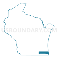
Outline

Summary
| Unique Area Identifier | 194392 |
| Name | Racine County PUMA |
| State | Wisconsin |
| Area (square miles) | 792.12 |
| Land Area (square miles) | 332.50 |
| Water Area (square miles) | 459.62 |
| % of Land Area | 41.98 |
| % of Water Area | 58.02 |
| Latitude of the Internal Point | 42.75536100 |
| Longtitude of the Internal Point | -87.48662130 |
Maps

Graphs
Select a template below for downloading or customizing gragh for Racine County PUMA, Wisconsin


Neighbors
Neighoring Public Use Microdata Area (by Name) Neighboring Public Use Microdata Area on the Map
- Allegan County PUMA, MI
- Kenosha County PUMA, WI
- Milwaukee County (South) PUMA, WI
- Ottawa County (West) PUMA, MI
- Walworth County PUMA, WI
- Waukesha County (East) PUMA, WI
- Waukesha County (West) PUMA, WI
Top 10 Neighboring County (by Population) Neighboring County on the Map
- Milwaukee County, WI (947,735)
- Waukesha County, WI (389,891)
- Ottawa County, MI (263,801)
- Racine County, WI (195,408)
- Kenosha County, WI (166,426)
- Allegan County, MI (111,408)
- Walworth County, WI (102,228)
Top 10 Neighboring County Subdivision (by Population) Neighboring County Subdivision on the Map
- Racine city, Racine County, WI (78,860)
- Franklin city, Milwaukee County, WI (35,451)
- Oak Creek city, Milwaukee County, WI (34,451)
- Mount Pleasant village, Racine County, WI (26,197)
- Caledonia village, Racine County, WI (24,705)
- Muskego city, Waukesha County, WI (24,135)
- Burlington city, Racine County, WI (10,464)
- Somers town, Kenosha County, WI (9,597)
- Mukwonago town, Waukesha County, WI (7,959)
- Norway town, Racine County, WI (7,948)
Top 10 Neighboring Place (by Population) Neighboring Place on the Map
- Racine city, WI (78,860)
- Franklin city, WI (35,451)
- Oak Creek city, WI (34,451)
- Mount Pleasant village, WI (26,197)
- Caledonia village, WI (24,705)
- Muskego city, WI (24,135)
- Burlington city, WI (10,464)
- Mukwonago village, WI (7,355)
- Sturtevant village, WI (6,970)
- Waterford village, WI (5,368)
Top 10 Neighboring Elementary School District (by Population) Neighboring Elementary School District on the Map
- Waterford Joint No. 1 School District, WI (13,791)
- Union Grove Joint No. 1 School District, WI (5,388)
- Wheatland Joint No. 1 School District, WI (4,166)
- Raymond No. 14 School District, WI (3,301)
- Yorkville Joint No. 2 School District, WI (2,776)
- Washington-Caldwell School District, WI (1,909)
- Norway Joint No. 7 School District, WI (1,814)
- Dover No. 1 School District, WI (1,813)
- Paris Joint No. 1 School District, WI (1,718)
- Brighton No. 1 School District, WI (1,347)
Top 10 Neighboring Secondary School District (by Population) Neighboring Secondary School District on the Map
- Westosha Central High School District, WI (19,682)
- Waterford Union High School District, WI (18,322)
- Union Grove Union High School District, WI (13,326)
Top 10 Neighboring Unified School District (by Population) Neighboring Unified School District on the Map
- Racine School District, WI (139,193)
- Kenosha School District, WI (127,931)
- Oak Creek-Franklin School District, WI (38,778)
- Muskego-Norway School District, WI (29,204)
- Franklin Public School District, WI (28,964)
- Mukwonago School District, WI (28,824)
- Burlington Area School District, WI (23,251)
- East Troy Community School District, WI (11,708)
- School District Not Defined (Water), MI (243)
- Norris School District, WI (85)
Top 10 Neighboring State Legislative District Lower Chamber (by Population) Neighboring State Legislative District Lower Chamber on the Map
- State House District 89, MI (96,358)
- State House District 80, MI (87,871)
- Assembly District 31, WI (61,767)
- Assembly District 66, WI (61,567)
- Assembly District 83, WI (61,206)
- Assembly District 21, WI (60,177)
- Assembly District 32, WI (60,152)
- Assembly District 82, WI (60,035)
- Assembly District 63, WI (58,881)
- Assembly District 64, WI (56,844)
Top 10 Neighboring State Legislative District Upper Chamber (by Population) Neighboring State Legislative District Upper Chamber on the Map
- State Senate District 30, MI (288,289)
- State Senate District 24, MI (278,340)
- State Senate District 11, WI (181,372)
- State Senate District 22, WI (180,019)
- State Senate District 28, WI (177,466)
- State Senate District 7, WI (172,003)
- State Senate District 21, WI (166,735)
Top 10 Neighboring 111th Congressional District (by Population) Neighboring 111th Congressional District on the Map
Top 10 Neighboring Census Tract (by Population) Neighboring Census Tract on the Map
- Census Tract 1603, Milwaukee County, WI (9,582)
- Census Tract 15.02, Racine County, WI (7,094)
- Census Tract 14, Racine County, WI (6,732)
- Census Tract 17.02, Racine County, WI (6,707)
- Census Tract 6.01, Kenosha County, WI (6,602)
- Census Tract 2, Walworth County, WI (6,556)
- Census Tract 12.02, Racine County, WI (6,512)
- Census Tract 28, Kenosha County, WI (6,335)
- Census Tract 11, Racine County, WI (6,192)
- Census Tract 16.01, Racine County, WI (6,054)
Top 10 Neighboring 5-Digit ZIP Code Tabulation Area (by Population) Neighboring 5-Digit ZIP Code Tabulation Area on the Map
- 53132, WI (34,863)
- 53154, WI (34,451)
- 53402, WI (33,174)
- 53140, WI (30,017)
- 53105, WI (29,225)
- 53403, WI (27,432)
- 53144, WI (27,256)
- 53406, WI (25,845)
- 53405, WI (25,193)
- 53150, WI (24,850)