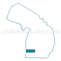
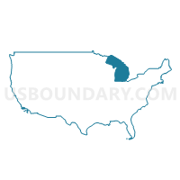
Allegan County PUMA, Michigan
About
Outline

Summary
| Unique Area Identifier | 193140 |
| Name | Allegan County PUMA |
| State | Michigan |
| Area (square miles) | 1,833.29 |
| Land Area (square miles) | 825.23 |
| Water Area (square miles) | 1,008.06 |
| % of Land Area | 45.01 |
| % of Water Area | 54.99 |
| Latitude of the Internal Point | 42.57397480 |
| Longtitude of the Internal Point | -86.63438190 |
Maps
Graphs
Select a template below for downloading or customizing gragh for Allegan County PUMA, Michigan


Neighbors
Neighoring Public Use Microdata Area (by Name) Neighboring Public Use Microdata Area on the Map
- Calhoun & Barry Counties PUMA, MI
- Kalamazoo County (Outer) PUMA, MI
- Kenosha County PUMA, WI
- Kent County (Southeast) PUMA, MI
- Kent County (Southwest) PUMA, MI
- Lake County (Northeast)--Waukegan, Zion, Benton & Newport Townships PUMA, IL
- Ottawa County (East) PUMA, MI
- Ottawa County (West) PUMA, MI
- Racine County PUMA, WI
- Van Buren & Cass Counties PUMA, MI
Top 10 Neighboring County (by Population) Neighboring County on the Map
- Lake County, IL (703,462)
- Kent County, MI (602,622)
- Ottawa County, MI (263,801)
- Kalamazoo County, MI (250,331)
- Racine County, WI (195,408)
- Kenosha County, WI (166,426)
- Allegan County, MI (111,408)
- Van Buren County, MI (76,258)
- Barry County, MI (59,173)
Top 10 Neighboring County Subdivision (by Population) Neighboring County Subdivision on the Map
- Holland charter township, Ottawa County, MI (35,636)
- Holland city, Ottawa County, MI (26,035)
- Gaines charter township, Kent County, MI (25,146)
- Byron township, Kent County, MI (20,317)
- Park township, Ottawa County, MI (17,802)
- Caledonia township, Kent County, MI (12,332)
- Cooper charter township, Kalamazoo County, MI (10,111)
- Zeeland charter township, Ottawa County, MI (9,971)
- Thornapple township, Barry County, MI (7,884)
- Dorr township, Allegan County, MI (7,439)
Top 10 Neighboring Place (by Population) Neighboring Place on the Map
- Holland city, MI (33,051)
- Allegan city, MI (4,998)
- South Haven city, MI (4,403)
- Wayland city, MI (4,079)
- Otsego city, MI (3,956)
- Plainwell city, MI (3,804)
- Fennville city, MI (1,398)
- Douglas city, MI (1,232)
- Saugatuck city, MI (925)
- Hopkins village, MI (610)
Top 10 Neighboring Elementary School District (by Population) Neighboring Elementary School District on the Map
Top 10 Neighboring Unified School District (by Population) Neighboring Unified School District on the Map
- Hudsonville Public School District, MI (37,248)
- Holland City School District, MI (36,507)
- Zeeland Public Schools, MI (30,843)
- Byron Center Public Schools, MI (21,796)
- Caledonia Community Schools, MI (21,389)
- Gull Lake Community Schools, MI (18,888)
- Wayland Union Schools, MI (17,580)
- Allegan Public Schools, MI (17,017)
- Plainwell Community Schools, MI (15,313)
- Thornapple Kellogg School District, MI (15,303)
Top 10 Neighboring State Legislative District Lower Chamber (by Population) Neighboring State Legislative District Lower Chamber on the Map
- State House District 61, MI (103,705)
- State House District 72, MI (103,319)
- State House District 88, MI (99,795)
- State House District 90, MI (97,061)
- State House District 87, MI (96,428)
- State House District 89, MI (96,358)
- State House District 60, MI (93,096)
- State House District 77, MI (92,442)
- State House District 80, MI (87,871)
- Assembly District 64, WI (56,844)
Top 10 Neighboring State Legislative District Upper Chamber (by Population) Neighboring State Legislative District Upper Chamber on the Map
- State Senate District 28, MI (306,724)
- State Senate District 30, MI (288,289)
- State Senate District 24, MI (278,340)
- State Senate District 20, MI (269,554)
- State Senate District 21, MI (266,141)
- State Senate District 22, WI (180,019)
- State Senate District 21, WI (166,735)
- State Senate Districts not defined, IL (0)
Top 10 Neighboring 111th Congressional District (by Population) Neighboring 111th Congressional District on the Map
- Congressional District 2, MI (698,831)
- Congressional District 3, MI (694,695)
- Congressional District 6, MI (671,883)
Top 10 Neighboring Census Tract (by Population) Neighboring Census Tract on the Map
- Census Tract 146.02, Kent County, MI (9,513)
- Census Tract 103, Barry County, MI (7,884)
- Census Tract 304.01, Allegan County, MI (7,439)
- Census Tract 303, Allegan County, MI (7,290)
- Census Tract 305, Allegan County, MI (7,281)
- Census Tract 148.07, Kent County, MI (6,964)
- Census Tract 101, Van Buren County, MI (6,881)
- Census Tract 230.02, Ottawa County, MI (6,529)
- Census Tract 311, Allegan County, MI (6,409)
- Census Tract 310, Allegan County, MI (6,214)
Top 10 Neighboring 5-Digit ZIP Code Tabulation Area (by Population) Neighboring 5-Digit ZIP Code Tabulation Area on the Map
- 49423, MI (44,977)
- 49426, MI (33,244)
- 49464, MI (27,481)
- 49316, MI (20,074)
- 49315, MI (19,915)
- 49010, MI (17,374)
- 49080, MI (15,802)
- 49090, MI (13,810)
- 49348, MI (12,153)
- 49333, MI (11,191)


