


FR020, Marion County, Indiana
About
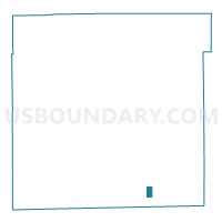
Outline

Summary
| Unique Area Identifier | 579102 |
| Name | FR020 |
| County | Marion County |
| State | Indiana |
| Area (square miles) | 0.52 |
| Land Area (square miles) | 0.52 |
| Water Area (square miles) | 0.00 |
| % of Land Area | 100.00 |
| % of Water Area | 0.00 |
| Latitude of the Internal Point | 39.65900530 |
| Longtitude of the Internal Point | -86.05884180 |
Maps


Graphs
Select a template below for downloading or customizing gragh for FR020, Marion County, Indiana


Neighbors
Neighoring Voting District (by Name) Neighboring Voting District on the Map
- FR016, Marion County, IN
- FR017, Marion County, IN
- FR019, Marion County, IN
- FR021, Marion County, IN
- FR024, Marion County, IN
- FR025, Marion County, IN