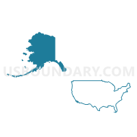
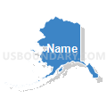
Alaska
About
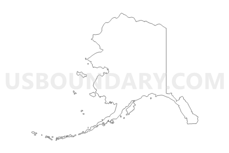
Outline
Summary
| Unique Area Identifier | 201753 |
| Name | Alaska |
| Area (square miles) | 665,384.02 |
| Land Area (square miles) | 570,640.93 |
| Water Area (square miles) | 94,743.09 |
| % of Land Area | 85.76 |
| % of Water Area | 14.24 |
| Latitude of the Internal Point | 63.34619100 |
| Longtitude of the Internal Point | -152.83706790 |
| Total Population | 710,231 |
| Total Housing Units | 306,967 |
| Total Households | 258,058 |
| Median Age | 33.8 |
Maps
Graphs
Select a template below for downloading or customizing gragh for Alaska





Neighbors
County in Alaska (by Name) Neighboring County on the Map
- Aleutians East Borough, AK
- Aleutians West Census Area, AK
- Anchorage Municipality, AK
- Bethel Census Area, AK
- Bristol Bay Borough, AK
- Denali Borough, AK
- Dillingham Census Area, AK
- Fairbanks North Star Borough, AK
- Haines Borough, AK
- Hoonah-Angoon Census Area, AK
- Juneau City and Borough, AK
- Kenai Peninsula Borough, AK
- Ketchikan Gateway Borough, AK
- Kodiak Island Borough, AK
- Lake and Peninsula Borough, AK
- Matanuska-Susitna Borough, AK
- Nome Census Area, AK
- North Slope Borough, AK
- Northwest Arctic Borough, AK
- Petersburg Census Area, AK
- Prince of Wales-Hyder Census Area, AK
- Sitka City and Borough, AK
- Skagway Municipality, AK
- Southeast Fairbanks Census Area, AK
- Valdez-Cordova Census Area, AK
- Wade Hampton Census Area, AK
- Wrangell City and Borough, AK
- Yakutat City and Borough, AK
- Yukon-Koyukuk Census Area, AK
Top 10 County Subdivision in Alaska (by Population) Neighboring County Subdivision on the Map
- Anchorage census subarea, Anchorage Municipality, AK (291,826)
- Fairbanks North Star census subarea, Fairbanks North Star Borough, AK (97,581)
- Matanuska-Susitna census subarea, Matanuska-Susitna Borough, AK (88,995)
- Kenai-Cook Inlet census subarea, Kenai Peninsula Borough, AK (49,733)
- Juneau census subarea, Juneau City and Borough, AK (31,275)
- Lower Kuskokwim census subarea, Bethel Census Area, AK (15,563)
- Kodiak Island census subarea, Kodiak Island Borough, AK (13,592)
- Ketchikan census subarea, Ketchikan Gateway Borough, AK (13,477)
- Nome census subarea, Nome Census Area, AK (9,492)
- North Slope census subarea, North Slope Borough, AK (9,430)
Top 10 Place in Alaska (by Population) Neighboring Place on the Map
- Anchorage municipality, AK (291,826)
- Fairbanks city, AK (31,535)
- Juneau city and borough, AK (31,275)
- Badger CDP, AK (19,482)
- Knik-Fairview CDP, AK (14,923)
- College CDP, AK (12,964)
- Sitka city and borough, AK (8,881)
- Lakes CDP, AK (8,364)
- Tanaina CDP, AK (8,197)
- Ketchikan city, AK (8,050)
Top 10 Unified School District in Alaska (by Population) Neighboring Unified School District on the Map
- Anchorage School District, AK (291,826)
- Fairbanks North Star Borough School District, AK (97,581)
- Matanuska-Susitna Borough School District, AK (88,995)
- Kenai Peninsula Borough School District, AK (55,400)
- Juneau Borough School District, AK (31,275)
- Lower Kuskokwim School District, AK (14,217)
- Kodiak Island Borough School District, AK (13,592)
- Ketchikan Gateway Borough School District, AK (13,477)
- North Slope Borough School District, AK (9,430)
- Sitka Borough School District, AK (8,881)
Top 10 State Legislative District Lower Chamber in Alaska (by Population) Neighboring State Legislative District Lower Chamber on the Map
- State House District 15, Rural Mat-Su, AK (25,974)
- State House District 14, Greater Wasilla, AK (23,682)
- State House District 13, Greater Palmer, AK (23,507)
- State House District 11, North Pole, AK (21,692)
- State House District 16, Chugiak-South Mat-Su, AK (21,559)
- State House District 7, Farmers Loop-Steese Highway, AK (20,982)
- State House District 8, Denali-University, AK (19,960)
- State House District 32, Chugach State Park, AK (19,952)
- State House District 24, Midtown-Taku, AK (19,355)
- State House District 18, Military, AK (19,255)
Top 10 State Legislative District Upper Chamber in Alaska (by Population) Neighboring State Legislative District Upper Chamber on the Map
- State Senate District H, AK (47,533)
- State Senate District G, AK (47,189)
- State Senate District D, AK (40,942)
- State Senate District P, AK (37,696)
- State Senate District Q, AK (37,402)
- State Senate District N, AK (36,520)
- State Senate District F, AK (36,503)
- State Senate District J, AK (36,344)
- State Senate District L, AK (36,313)
- State Senate District O, AK (36,303)
Top 10 111th Congressional District in Alaska (by Population) Neighboring 111th Congressional District on the Map
Top 10 Census Tract in Alaska (by Population) Neighboring Census Tract on the Map
- Census Tract 19, Fairbanks North Star Borough, AK (11,684)
- Census Tract 2.03, Anchorage Municipality, AK (10,549)
- Census Tract 15, Fairbanks North Star Borough, AK (10,052)
- Census Tract 7, Kenai Peninsula Borough, AK (9,939)
- Census Tract 27.02, Anchorage Municipality, AK (9,670)
- Census Tract 1, Bethel Census Area, AK (9,483)
- Census Tract 23.03, Anchorage Municipality, AK (9,273)
- Census Tract 27.12, Anchorage Municipality, AK (9,068)
- Census Tract 11, Fairbanks North Star Borough, AK (8,143)
- Census Tract 3, Anchorage Municipality, AK (8,000)
Top 10 5-Digit ZIP Code Tabulation Area in Alaska (by Population) Neighboring 5-Digit ZIP Code Tabulation Area on the Map
- 99654, AK (52,168)
- 99504, AK (40,914)
- 99507, AK (37,850)
- 99508, AK (35,857)
- 99709, AK (29,830)
- 99801, AK (29,164)
- 99577, AK (25,771)
- 99645, AK (25,176)
- 99502, AK (24,168)
- 99705, AK (22,544)
Data
Demographic, Population, Households, and Housing Units
** Data sources from census 2010 **
Show Data on Map
Download Full List as CSV
Download Quick Sheet as CSV
| Subject | This Area | National |
|---|---|---|
| POPULATION | ||
| Total Population Map | 710,231 | 308,745,538 |
| POPULATION, HISPANIC OR LATINO ORIGIN | ||
| Not Hispanic or Latino Map | 670,982 | 258,267,944 |
| Hispanic or Latino Map | 39,249 | 50,477,594 |
| POPULATION, RACE | ||
| White alone Map | 473,576 | 223,553,265 |
| Black or African American alone Map | 23,263 | 38,929,319 |
| American Indian and Alaska Native alone Map | 104,871 | 2,932,248 |
| Asian alone Map | 38,135 | 14,674,252 |
| Native Hawaiian and Other Pacific Islander alone Map | 7,409 | 540,013 |
| Some Other Race alone Map | 11,102 | 19,107,368 |
| Two or More Races Map | 51,875 | 9,009,073 |
| POPULATION, SEX | ||
| Male Map | 369,628 | 151,781,326 |
| Female Map | 340,603 | 156,964,212 |
| POPULATION, AGE (18 YEARS) | ||
| 18 years and over Map | 522,853 | 234,564,071 |
| Under 18 years | 187,378 | 74,181,467 |
| POPULATION, AGE | ||
| Under 5 years | 53,996 | 20,201,362 |
| 5 to 9 years | 50,887 | 20,348,657 |
| 10 to 14 years | 50,816 | 20,677,194 |
| 15 to 17 years | 31,679 | 12,954,254 |
| 18 and 19 years | 20,462 | 9,086,089 |
| 20 years | 10,628 | 4,519,129 |
| 21 years | 10,577 | 4,354,294 |
| 22 to 24 years | 33,214 | 12,712,576 |
| 25 to 29 years | 55,419 | 21,101,849 |
| 30 to 34 years | 47,706 | 19,962,099 |
| 35 to 39 years | 45,833 | 20,179,642 |
| 40 to 44 years | 47,141 | 20,890,964 |
| 45 to 49 years | 54,726 | 22,708,591 |
| 50 to 54 years | 56,300 | 22,298,125 |
| 55 to 59 years | 49,971 | 19,664,805 |
| 60 and 61 years | 16,471 | 7,113,727 |
| 62 to 64 years | 19,467 | 9,704,197 |
| 65 and 66 years | 10,103 | 5,319,902 |
| 67 to 69 years | 12,099 | 7,115,361 |
| 70 to 74 years | 13,148 | 9,278,166 |
| 75 to 79 years | 8,892 | 7,317,795 |
| 80 to 84 years | 5,985 | 5,743,327 |
| 85 years and over | 4,711 | 5,493,433 |
| MEDIAN AGE BY SEX | ||
| Both sexes Map | 33.80 | 37.20 |
| Male Map | 33.60 | 35.80 |
| Female Map | 34.10 | 38.50 |
| HOUSEHOLDS | ||
| Total Households Map | 258,058 | 116,716,292 |
| HOUSEHOLDS, HOUSEHOLD TYPE | ||
| Family households: Map | 170,750 | 77,538,296 |
| Husband-wife family Map | 127,558 | 56,510,377 |
| Other family: Map | 43,192 | 21,027,919 |
| Male householder, no wife present Map | 15,455 | 5,777,570 |
| Female householder, no husband present Map | 27,737 | 15,250,349 |
| Nonfamily households: Map | 87,308 | 39,177,996 |
| Householder living alone Map | 66,073 | 31,204,909 |
| Householder not living alone Map | 21,235 | 7,973,087 |
| HOUSEHOLDS, HISPANIC OR LATINO ORIGIN OF HOUSEHOLDER | ||
| Not Hispanic or Latino householder: Map | 247,802 | 103,254,926 |
| Hispanic or Latino householder: Map | 10,256 | 13,461,366 |
| HOUSEHOLDS, RACE OF HOUSEHOLDER | ||
| Householder who is White alone | 193,099 | 89,754,352 |
| Householder who is Black or African American alone | 8,431 | 14,129,983 |
| Householder who is American Indian and Alaska Native alone | 30,342 | 939,707 |
| Householder who is Asian alone | 9,710 | 4,632,164 |
| Householder who is Native Hawaiian and Other Pacific Islander alone | 1,686 | 143,932 |
| Householder who is Some Other Race alone | 3,330 | 4,916,427 |
| Householder who is Two or More Races | 11,460 | 2,199,727 |
| HOUSEHOLDS, HOUSEHOLD TYPE BY HOUSEHOLD SIZE | ||
| Family households: Map | 170,750 | 77,538,296 |
| 2-person household Map | 66,531 | 31,882,616 |
| 3-person household Map | 39,241 | 17,765,829 |
| 4-person household Map | 33,269 | 15,214,075 |
| 5-person household Map | 17,872 | 7,411,997 |
| 6-person household Map | 7,452 | 3,026,278 |
| 7-or-more-person household Map | 6,385 | 2,237,501 |
| Nonfamily households: Map | 87,308 | 39,177,996 |
| 1-person household Map | 66,073 | 31,204,909 |
| 2-person household Map | 17,321 | 6,360,012 |
| 3-person household Map | 2,650 | 992,156 |
| 4-person household Map | 855 | 411,171 |
| 5-person household Map | 250 | 126,634 |
| 6-person household Map | 94 | 48,421 |
| 7-or-more-person household Map | 65 | 34,693 |
| HOUSING UNITS | ||
| Total Housing Units Map | 306,967 | 131,704,730 |
| HOUSING UNITS, OCCUPANCY STATUS | ||
| Occupied Map | 258,058 | 116,716,292 |
| Vacant Map | 48,909 | 14,988,438 |
| HOUSING UNITS, OCCUPIED, TENURE | ||
| Owned with a mortgage or a loan Map | 112,012 | 52,979,430 |
| Owned free and clear Map | 50,753 | 23,006,644 |
| Renter occupied Map | 95,293 | 40,730,218 |
| HOUSING UNITS, VACANT, VACANCY STATUS | ||
| For rent Map | 6,729 | 4,137,567 |
| Rented, not occupied Map | 667 | 206,825 |
| For sale only Map | 2,876 | 1,896,796 |
| Sold, not occupied Map | 1,006 | 421,032 |
| For seasonal, recreational, or occasional use Map | 27,901 | 4,649,298 |
| For migrant workers Map | 362 | 24,161 |
| Other vacant Map | 9,368 | 3,652,759 |
| HOUSING UNITS, OCCUPIED, AVERAGE HOUSEHOLD SIZE BY TENURE | ||
| Total: Map | 2.65 | 2.58 |
| Owner occupied Map | 2.76 | 2.65 |
| Renter occupied Map | 2.47 | 2.44 |
| HOUSING UNITS, OCCUPIED, TENURE BY RACE OF HOUSEHOLDER | ||
| Owner occupied: Map | 162,765 | 75,986,074 |
| Householder who is White alone Map | 129,210 | 63,446,275 |
| Householder who is Black or African American alone Map | 3,060 | 6,261,464 |
| Householder who is American Indian and Alaska Native alone Map | 17,310 | 509,588 |
| Householder who is Asian alone Map | 5,345 | 2,688,861 |
| Householder who is Native Hawaiian and Other Pacific Islander alone Map | 513 | 61,911 |
| Householder who is Some Other Race alone Map | 1,506 | 1,975,817 |
| Householder who is Two or More Races Map | 5,821 | 1,042,158 |
| Renter occupied: Map | 95,293 | 40,730,218 |
| Householder who is White alone Map | 63,889 | 26,308,077 |
| Householder who is Black or African American alone Map | 5,371 | 7,868,519 |
| Householder who is American Indian and Alaska Native alone Map | 13,032 | 430,119 |
| Householder who is Asian alone Map | 4,365 | 1,943,303 |
| Householder who is Native Hawaiian and Other Pacific Islander alone Map | 1,173 | 82,021 |
| Householder who is Some Other Race alone Map | 1,824 | 2,940,610 |
| Householder who is Two or More Races Map | 5,639 | 1,157,569 |
| HOUSING UNITS, OCCUPIED, TENURE BY HISPANIC OR LATINO ORIGIN OF HOUSEHOLDER | ||
| Owner occupied: Map | 162,765 | 75,986,074 |
| Not Hispanic or Latino householder Map | 157,925 | 69,617,625 |
| Hispanic or Latino householder Map | 4,840 | 6,368,449 |
| Renter occupied: Map | 95,293 | 40,730,218 |
| Not Hispanic or Latino householder Map | 89,877 | 33,637,301 |
| Hispanic or Latino householder Map | 5,416 | 7,092,917 |
| HOUSING UNITS, OCCUPIED, TENURE BY HOUSEHOLD SIZE | ||
| Owner occupied: Map | 162,765 | 75,986,074 |
| 1-person household Map | 33,371 | 16,453,569 |
| 2-person household Map | 57,619 | 27,618,605 |
| 3-person household Map | 27,211 | 12,517,563 |
| 4-person household Map | 23,189 | 10,998,793 |
| 5-person household Map | 11,981 | 5,057,765 |
| 6-person household Map | 5,011 | 1,965,796 |
| 7-or-more-person household Map | 4,383 | 1,373,983 |
| Renter occupied: Map | 95,293 | 40,730,218 |
| 1-person household Map | 32,702 | 14,751,340 |
| 2-person household Map | 26,233 | 10,624,023 |
| 3-person household Map | 14,680 | 6,240,422 |
| 4-person household Map | 10,935 | 4,626,453 |
| 5-person household Map | 6,141 | 2,480,866 |
| 6-person household Map | 2,535 | 1,108,903 |
| 7-or-more-person household Map | 2,067 | 898,211 |
Loading...


