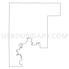
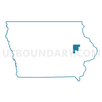
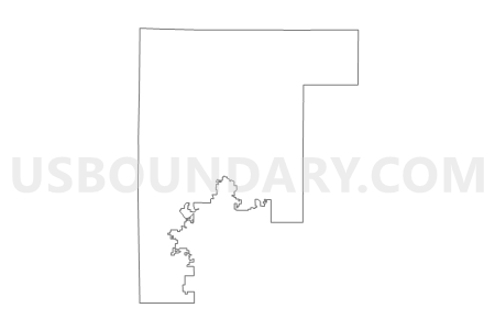
State Senate District 18, Iowa
About
** Data sources from census 2010 **
Maps
Graphs
Neighbors
Neighoring State Legislative District Upper Chamber (by Name) Neighboring State Legislative District Upper Chamber on the Map
- State Senate District 12, IA
- State Senate District 15, IA
- State Senate District 16, IA
- State Senate District 17, IA
- State Senate District 19, IA
- State Senate District 20, IA
- State Senate District 38, IA
Top 10 Neighboring County (by Population) Neighboring County on the Map
- Linn County, IA (211,226)
- Johnson County, IA (130,882)
- Benton County, IA (26,076)
- Buchanan County, IA (20,958)
- Jones County, IA (20,638)
- Delaware County, IA (17,764)
- Iowa County, IA (16,355)
Top 10 Neighboring County Subdivision (by Population) Neighboring County Subdivision on the Map
- Cedar Rapids city, Linn County, IA (126,326)
- Marion township, Linn County, IA (38,947)
- Monroe township, Linn County, IA (13,020)
- Jefferson township, Johnson County, IA (4,122)
- Fairfax township, Linn County, IA (3,533)
- Washington township, Linn County, IA (3,369)
- Fremont township, Benton County, IA (2,442)
- Bertram township, Linn County, IA (2,387)
- Polk township, Benton County, IA (2,302)
- Florence township, Benton County, IA (2,108)
Top 10 Neighboring Place (by Population) Neighboring Place on the Map
- Cedar Rapids city, IA (126,326)
- Marion city, IA (34,768)
- Hiawatha city, IA (7,024)
- Robins city, IA (3,142)
- Center Point city, IA (2,421)
- Fairfax city, IA (2,123)
- Walford city, IA (1,463)
- Central City city, IA (1,257)
- Palo city, IA (1,026)
- Walker city, IA (791)
Top 10 Neighboring Unified School District (by Population) Neighboring Unified School District on the Map
- Cedar Rapids Community School District, IA (119,310)
- Linn-Mar Community School District, IA (36,539)
- College Community School District, IA (23,720)
- Marion Independent School District, IA (11,990)
- Vinton-Shellsburg Community School District, IA (10,406)
- West Delaware County Community School District, IA (9,509)
- Anamosa Community School District, IA (9,447)
- Benton Community School District, IA (9,140)
- Monticello Community School District, IA (6,519)
- Mount Vernon Community School District, IA (6,367)
Top 10 Neighboring State Legislative District Lower Chamber (by Population) Neighboring State Legislative District Lower Chamber on the Map
- State House District 36, IA (37,187)
- State House District 35, IA (35,173)
- State House District 29, IA (33,364)
- State House District 33, IA (32,311)
- State House District 31, IA (31,907)
- State House District 37, IA (31,767)
- State House District 32, IA (30,747)
- State House District 39, IA (29,919)
- State House District 76, IA (28,866)
- State House District 23, IA (28,807)
Top 10 Neighboring 111th Congressional District (by Population) Neighboring 111th Congressional District on the Map
- Congressional District 3, IA (642,116)
- Congressional District 2, IA (620,856)
- Congressional District 1, IA (596,443)
Top 10 Neighboring Census Tract (by Population) Neighboring Census Tract on the Map
- Census Tract 1, Linn County, IA (12,535)
- Census Tract 30.01, Linn County, IA (9,226)
- Census Tract 2.06, Linn County, IA (7,563)
- Census Tract 2.03, Linn County, IA (7,536)
- Census Tract 30.02, Linn County, IA (7,327)
- Census Tract 5, Linn County, IA (6,159)
- Census Tract 9.02, Linn County, IA (6,092)
- Census Tract 9.01, Linn County, IA (5,888)
- Census Tract 106, Linn County, IA (5,827)
- Census Tract 9605, Benton County, IA (5,760)
Top 10 Neighboring 5-Digit ZIP Code Tabulation Area (by Population) Neighboring 5-Digit ZIP Code Tabulation Area on the Map
- 52402, IA (40,149)
- 52404, IA (37,796)
- 52302, IA (36,980)
- 52403, IA (23,673)
- 52405, IA (23,621)
- 52205, IA (8,682)
- 52349, IA (7,643)
- 52233, IA (6,981)
- 52411, IA (6,896)
- 52310, IA (6,431)


