


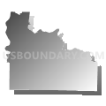
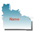
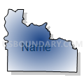
Lawrence, Giles, Wayne, Lewis & Perry Counties PUMA, Tennessee
About
Outline

Summary
| Unique Area Identifier | 194001 |
| Name | Lawrence, Giles, Wayne, Lewis & Perry Counties PUMA |
| State | Tennessee |
| Area (square miles) | 2,670.18 |
| Land Area (square miles) | 2,658.98 |
| Water Area (square miles) | 11.20 |
| % of Land Area | 99.58 |
| % of Water Area | 0.42 |
| Latitude of the Internal Point | 35.32092490 |
| Longtitude of the Internal Point | -87.51584590 |
Maps


Graphs
Select a template below for downloading or customizing gragh for Lawrence, Giles, Wayne, Lewis & Perry Counties PUMA, Tennessee


Neighbors
Neighoring Public Use Microdata Area (by Name) Neighboring Public Use Microdata Area on the Map
- Coffee, Franklin, Lincoln & Moore Counties PUMA, TN
- Henderson, Hardeman, McNairy, Hardin, Haywood & Decatur Counties PUMA, TN
- Land Between the Lakes--Weakley, Henry, Carroll, Humphreys, Benton & Houston Counties PUMA, TN
- Lauderdale, Colbert, Franklin & Marion (Northeast) Counties PUMA, AL
- Limestone & Madison (Outer) Counties--Huntsville City (Far West & Southwest) PUMA, AL
- Maury, Bedford & Marshall Counties PUMA, TN
- Robertson, Dickson, Cheatham & Hickman Counties PUMA, TN
Top 10 Neighboring County (by Population) Neighboring County on the Map
- Lauderdale County, AL (92,709)
- Limestone County, AL (82,782)
- Maury County, TN (80,956)
- Lawrence County, TN (41,869)
- Lincoln County, TN (33,361)
- Marshall County, TN (30,617)
- Giles County, TN (29,485)
- Hardin County, TN (26,026)
- Hickman County, TN (24,690)
- Humphreys County, TN (18,538)
Top 10 Neighboring County Subdivision (by Population) Neighboring County Subdivision on the Map
- Athens CCD, Limestone County, AL (69,761)
- Florence CCD, Lauderdale County, AL (50,499)
- Killen CCD, Lauderdale County, AL (16,161)
- Rogersville CCD, Lauderdale County, AL (8,630)
- District 7, Maury County, TN (7,397)
- District 8, Maury County, TN (7,333)
- District 10, Maury County, TN (6,913)
- District 9, Maury County, TN (6,578)
- Cloverdale CCD, Lauderdale County, AL (6,563)
- Lexington CCD, Lauderdale County, AL (4,480)
Top 10 Neighboring Place (by Population) Neighboring Place on the Map
- Lawrenceburg city, TN (10,428)
- Pulaski city, TN (7,870)
- Hohenwald city, TN (3,757)
- Clifton city, TN (2,694)
- Waynesboro city, TN (2,449)
- Loretto city, TN (1,714)
- Ardmore city, TN (1,213)
- Ardmore town, AL (1,194)
- Cornersville town, TN (1,194)
- Collinwood city, TN (982)
Top 10 Neighboring Unified School District (by Population) Neighboring Unified School District on the Map
- Maury County School District, TN (80,956)
- Limestone County School District, AL (57,348)
- Lauderdale County School District, AL (53,390)
- Lawrence County School District, TN (41,869)
- Marshall County School District, TN (30,617)
- Giles County School District, TN (29,485)
- Lincoln County School District, TN (26,534)
- Hardin County School District, TN (26,026)
- Hickman County School District, TN (24,690)
- Humphreys County School District, TN (18,538)
Top 10 Neighboring State Legislative District Lower Chamber (by Population) Neighboring State Legislative District Lower Chamber on the Map
- State House District 64, TN (69,239)
- State House District 62, TN (68,966)
- State House District 72, TN (63,136)
- State House District 75, TN (62,143)
- State House District 39, TN (60,823)
- State House District 65, TN (60,102)
- State House District 74, TN (58,574)
- State House District 70, TN (58,427)
- State House District 71, TN (58,246)
- State House District 5, AL (48,495)
Top 10 Neighboring State Legislative District Upper Chamber (by Population) Neighboring State Legislative District Upper Chamber on the Map
- State Senate District 13, TN (227,448)
- State Senate District 26, TN (185,292)
- State Senate District 24, TN (184,244)
- State Senate District 2, AL (179,058)
- State Senate District 25, TN (176,409)
- State Senate District 1, AL (135,057)
Top 10 Neighboring 111th Congressional District (by Population) Neighboring 111th Congressional District on the Map
- Congressional District 7, TN (792,605)
- Congressional District 6, TN (788,754)
- Congressional District 5, AL (718,724)
- Congressional District 4, TN (688,008)
- Congressional District 8, TN (658,258)
Top 10 Neighboring Census Tract (by Population) Neighboring Census Tract on the Map
- Census Tract 9702, Lewis County, TN (7,632)
- Census Tract 114, Lauderdale County, AL (6,563)
- Census Tract 9203, Giles County, TN (6,441)
- Census Tract 110.02, Maury County, TN (6,431)
- Census Tract 201.02, Limestone County, AL (6,317)
- Census Tract 112, Maury County, TN (5,905)
- Census Tract 9552, Marshall County, TN (5,699)
- Census Tract 9502, Wayne County, TN (5,603)
- Census Tract 9205, Hardin County, TN (5,555)
- Census Tract 9604.01, Lawrence County, TN (5,382)
Top 10 Neighboring 5-Digit ZIP Code Tabulation Area (by Population) Neighboring 5-Digit ZIP Code Tabulation Area on the Map
- 38464, TN (22,293)
- 35633, AL (20,877)
- 38478, TN (17,733)
- 38372, TN (17,595)
- 35645, AL (14,060)
- 38462, TN (10,297)
- 35634, AL (9,711)
- 35620, AL (8,868)
- 37185, TN (8,638)
- 37033, TN (7,805)