


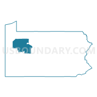
Venango, Jefferson, Clarion & Forest Counties PUMA, Pennsylvania
About
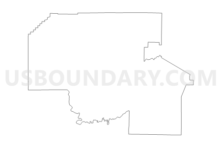
Outline

Summary
| Unique Area Identifier | 193907 |
| Name | Venango, Jefferson, Clarion & Forest Counties PUMA |
| State | Pennsylvania |
| Area (square miles) | 2,379.98 |
| Land Area (square miles) | 2,354.73 |
| Water Area (square miles) | 25.24 |
| % of Land Area | 98.94 |
| % of Water Area | 1.06 |
| Latitude of the Internal Point | 41.29015280 |
| Longtitude of the Internal Point | -79.35399230 |
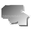
Maps

Graphs
Select a template below for downloading or customizing gragh for Venango, Jefferson, Clarion & Forest Counties PUMA, Pennsylvania


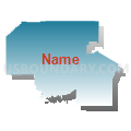
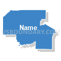


Neighbors
Neighoring Public Use Microdata Area (by Name) Neighboring Public Use Microdata Area on the Map
- Butler County PUMA, PA
- Clearfield, McKean, Elk, Potter & Cameron Counties PUMA, PA
- Crawford & Warren Counties PUMA, PA
- Indiana & Armstrong Counties PUMA, PA
- Mercer County PUMA, PA
Top 10 Neighboring County (by Population) Neighboring County on the Map
- Butler County, PA (183,862)
- Mercer County, PA (116,638)
- Indiana County, PA (88,880)
- Crawford County, PA (88,765)
- Clearfield County, PA (81,642)
- Armstrong County, PA (68,941)
- Venango County, PA (54,984)
- Jefferson County, PA (45,200)
- Warren County, PA (41,815)
- Clarion County, PA (39,988)
Top 10 Neighboring County Subdivision (by Population) Neighboring County Subdivision on the Map
- Sandy township, Clearfield County, PA (10,625)
- Oil City city, Venango County, PA (10,557)
- Cranberry township, Venango County, PA (6,685)
- Franklin city, Venango County, PA (6,545)
- Punxsutawney borough, Jefferson County, PA (5,962)
- Titusville city, Crawford County, PA (5,601)
- Sugarcreek borough, Venango County, PA (5,294)
- Clarion borough, Clarion County, PA (5,276)
- Pine township, Mercer County, PA (5,150)
- Clarion township, Clarion County, PA (4,116)
Top 10 Neighboring Place (by Population) Neighboring Place on the Map
- Oil City city, PA (10,557)
- Franklin city, PA (6,545)
- Punxsutawney borough, PA (5,962)
- Titusville city, PA (5,601)
- Sugarcreek borough, PA (5,294)
- Clarion borough, PA (5,276)
- Brookville borough, PA (3,924)
- Treasure Lake CDP, PA (3,861)
- Marienville CDP, PA (3,137)
- Reynoldsville borough, PA (2,759)
Top 10 Neighboring Unified School District (by Population) Neighboring Unified School District on the Map
- Armstrong School District, PA (43,364)
- Warren County School District, PA (38,402)
- DuBois Area School District, PA (30,976)
- Crawford Central School District, PA (30,672)
- Penncrest School District, PA (24,644)
- Punxsutawney Area School District, PA (21,024)
- Slippery Rock Area School District, PA (20,583)
- Grove City Area School District, PA (17,699)
- Franklin Area School District, PA (16,283)
- Oil City Area School District, PA (15,053)
Top 10 Neighboring State Legislative District Lower Chamber (by Population) Neighboring State Legislative District Lower Chamber on the Map
- State House District 8, PA (62,230)
- State House District 65, PA (59,457)
- State House District 64, PA (59,331)
- State House District 17, PA (58,819)
- State House District 74, PA (58,607)
- State House District 6, PA (58,259)
- State House District 66, PA (58,212)
- State House District 63, PA (56,952)
- State House District 75, PA (54,981)
Top 10 Neighboring State Legislative District Upper Chamber (by Population) Neighboring State Legislative District Upper Chamber on the Map
- State Senate District 41, PA (236,058)
- State Senate District 50, PA (235,966)
- State Senate District 21, PA (235,571)
- State Senate District 25, PA (233,497)
Top 10 Neighboring 111th Congressional District (by Population) Neighboring 111th Congressional District on the Map
- Congressional District 9, PA (666,810)
- Congressional District 5, PA (651,762)
- Congressional District 3, PA (640,356)
Top 10 Neighboring Census Tract (by Population) Neighboring Census Tract on the Map
- Census Tract 325.01, Mercer County, PA (6,214)
- Census Tract 328, Mercer County, PA (5,948)
- Census Tract 9506, Jefferson County, PA (5,837)
- Census Tract 2002, Venango County, PA (5,830)
- Census Tract 3304, Clearfield County, PA (5,725)
- Census Tract 1113, Crawford County, PA (5,662)
- Census Tract 9503, Jefferson County, PA (5,565)
- Census Tract 2006, Venango County, PA (5,294)
- Census Tract 1606, Clarion County, PA (5,276)
- Census Tract 9510, Elk County, PA (5,082)
Top 10 Neighboring 5-Digit ZIP Code Tabulation Area (by Population) Neighboring 5-Digit ZIP Code Tabulation Area on the Map
- 15801, PA (19,270)
- 16323, PA (16,372)
- 16301, PA (16,321)
- 16127, PA (16,145)
- 15767, PA (14,668)
- 16354, PA (11,379)
- 16214, PA (10,127)
- 15825, PA (9,562)
- 15851, PA (6,671)
- 15853, PA (6,578)