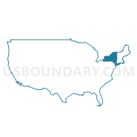
Cattaraugus & Allegany Counties PUMA, New York
About
Outline

Summary
| Unique Area Identifier | 193531 |
| Name | Cattaraugus & Allegany Counties PUMA |
| State | New York |
| Area (square miles) | 2,356.87 |
| Land Area (square miles) | 2,337.66 |
| Water Area (square miles) | 19.21 |
| % of Land Area | 99.18 |
| % of Water Area | 0.82 |
| Latitude of the Internal Point | 42.25785580 |
| Longtitude of the Internal Point | -78.38748530 |
Maps
Graphs
Select a template below for downloading or customizing gragh for Cattaraugus & Allegany Counties PUMA, New York


Neighbors
Neighoring Public Use Microdata Area (by Name) Neighboring Public Use Microdata Area on the Map
- Chautauqua County PUMA, NY
- Clearfield, McKean, Elk, Potter & Cameron Counties PUMA, PA
- Crawford & Warren Counties PUMA, PA
- Erie County (South) PUMA, NY
- Livingston & Wyoming Counties PUMA, NY
- Steuben (North & West), Schuyler & Chemung (North) Counties PUMA, NY
Top 10 Neighboring County (by Population) Neighboring County on the Map
- Erie County, NY (919,040)
- Chautauqua County, NY (134,905)
- Steuben County, NY (98,990)
- Cattaraugus County, NY (80,317)
- Livingston County, NY (65,393)
- Allegany County, NY (48,946)
- McKean County, PA (43,450)
- Wyoming County, NY (42,155)
- Warren County, PA (41,815)
- Potter County, PA (17,457)
Top 10 Neighboring County Subdivision (by Population) Neighboring County Subdivision on the Map
- Olean city, Cattaraugus County, NY (14,452)
- Concord town, Erie County, NY (8,494)
- Allegany town, Cattaraugus County, NY (8,004)
- Wellsville town, Allegany County, NY (7,397)
- Hanover town, Chautauqua County, NY (7,127)
- Collins town, Erie County, NY (6,601)
- Salamanca city, Cattaraugus County, NY (5,815)
- Alfred town, Allegany County, NY (5,237)
- Foster township, McKean County, PA (4,316)
- Arcade town, Wyoming County, NY (4,205)
Top 10 Neighboring Place (by Population) Neighboring Place on the Map
- Olean city, NY (14,452)
- Salamanca city, NY (5,815)
- Wellsville village, NY (4,679)
- Alfred village, NY (4,174)
- Gowanda village, NY (2,709)
- Arcade village, NY (2,071)
- St. Bonaventure CDP, NY (2,044)
- Allegany village, NY (1,816)
- Franklinville village, NY (1,740)
- Houghton CDP, NY (1,693)
Top 10 Neighboring Unified School District (by Population) Neighboring Unified School District on the Map
- Warren County School District, PA (38,402)
- Bradford Area School District, PA (21,133)
- Yorkshire-Pioneer Central School District, NY (16,029)
- Olean City School District, NY (15,838)
- Springville-Griffith Institute Central School District, NY (13,422)
- Gowanda Central School District, NY (11,537)
- Dansville Central School District, NY (10,145)
- Allegany-Limestone Central School District, NY (9,475)
- Wellsville Central School District, NY (9,262)
- Salamanca City School District, NY (7,712)
Top 10 Neighboring State Legislative District Lower Chamber (by Population) Neighboring State Legislative District Lower Chamber on the Map
- Assembly District 146, NY (128,575)
- Assembly District 147, NY (124,739)
- Assembly District 136, NY (124,338)
- Assembly District 150, NY (121,520)
- Assembly District 149, NY (121,064)
- State House District 65, PA (59,457)
- State House District 67, PA (56,066)
Top 10 Neighboring State Legislative District Upper Chamber (by Population) Neighboring State Legislative District Upper Chamber on the Map
- State Senate District 59, NY (297,961)
- State Senate District 53, NY (295,046)
- State Senate District 57, NY (285,036)
- State Senate District 21, PA (235,571)
- State Senate District 25, PA (233,497)
Top 10 Neighboring 111th Congressional District (by Population) Neighboring 111th Congressional District on the Map
- Congressional District 26, NY (674,804)
- Congressional District 29, NY (663,727)
- Congressional District 5, PA (651,762)
- Congressional District 3, PA (640,356)
- Congressional District 27, NY (629,271)
Top 10 Neighboring Census Tract (by Population) Neighboring Census Tract on the Map
- Census Tract 9403, Cattaraugus County, NY (6,490)
- Census Tract 9508, Allegany County, NY (6,384)
- Census Tract 4206, McKean County, PA (5,556)
- Census Tract 9613, Cattaraugus County, NY (5,287)
- Census Tract 9605, Cattaraugus County, NY (5,253)
- Census Tract 9614, Cattaraugus County, NY (5,189)
- Census Tract 9512, Allegany County, NY (5,086)
- Census Tract 361, Chautauqua County, NY (5,018)
- Census Tract 9503, Allegany County, NY (4,927)
- Census Tract 375, Chautauqua County, NY (4,874)
Top 10 Neighboring 5-Digit ZIP Code Tabulation Area (by Population) Neighboring 5-Digit ZIP Code Tabulation Area on the Map
- 14760, NY (18,775)
- 16701, PA (17,980)
- 14843, NY (13,043)
- 14437, NY (11,415)
- 14895, NY (9,616)
- 14141, NY (7,728)
- 14779, NY (6,932)
- 14070, NY (6,732)
- 14706, NY (6,356)
- 14009, NY (5,672)


