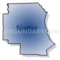
Northeast Missouri PUMA, Missouri
About
Outline

Summary
| Unique Area Identifier | 193274 |
| Name | Northeast Missouri PUMA |
| State | Missouri |
| Area (square miles) | 5,759.33 |
| Land Area (square miles) | 5,681.49 |
| Water Area (square miles) | 77.84 |
| % of Land Area | 98.65 |
| % of Water Area | 1.35 |
| Latitude of the Internal Point | 39.98088520 |
| Longtitude of the Internal Point | -92.08359500 |
Maps
Graphs
Select a template below for downloading or customizing gragh for Northeast Missouri PUMA, Missouri


Neighbors
Neighoring Public Use Microdata Area (by Name) Neighboring Public Use Microdata Area on the Map
- Adams, Pike, Brown, Schuyler & Mason Counties PUMA, IL
- Des Moines, Lee, Henry & Louisa Counties PUMA, IA
- Henry, Mercer, Henderson, Warren, Hancock, McDonough & Fulton Counties PUMA, IL
- Lincoln, Warren, Audrain, Pike & Montgomery Counties PUMA, MO
- Northwest Missouri PUMA, MO
- Pettis, Randolph, Saline, Cooper, Howard, Carroll & Chariton Counties PUMA, MO
- South Central Iowa PUMA, IA
- Wapello, Mahaska, Washington, Jefferson, Keokuk, Davis & Van Buren Counties PUMA, IA
Top 10 Neighboring County (by Population) Neighboring County on the Map
- Adams County, IL (67,103)
- Lee County, IA (35,862)
- Marion County, MO (28,781)
- Adair County, MO (25,607)
- Audrain County, MO (25,529)
- Randolph County, MO (25,414)
- Hancock County, IL (19,104)
- Pike County, MO (18,516)
- Pike County, IL (16,430)
- Macon County, MO (15,566)
Top 10 Neighboring County Subdivision (by Population) Neighboring County Subdivision on the Map
- Benton township, Adair County, MO (19,700)
- Mason township, Marion County, MO (13,438)
- Keokuk city, Lee County, IA (10,780)
- Salt River township, Audrain County, MO (9,497)
- South Sugar Creek township, Randolph County, MO (7,499)
- Hudson township, Macon County, MO (6,722)
- Miller township, Marion County, MO (5,997)
- Melrose township, Adams County, IL (5,746)
- Cuivre township, Audrain County, MO (5,125)
- Liberty township, Marion County, MO (4,500)
Top 10 Neighboring Place (by Population) Neighboring Place on the Map
- Hannibal city, MO (17,916)
- Kirksville city, MO (17,505)
- Keokuk city, IA (10,780)
- Macon city, MO (5,471)
- Vandalia city, MO (3,899)
- Palmyra city, MO (3,595)
- Hamilton city, IL (2,951)
- Monroe City city, MO (2,531)
- Canton city, MO (2,377)
- Kahoka city, MO (2,078)
Top 10 Neighboring Elementary School District (by Population) Neighboring Elementary School District on the Map
- Renick R-V School District, MO (1,210)
- Middle Grove C-1 School District, MO (691)
- Callao C-8 School District, MO (645)
- Holliday C-2 School District, MO (563)
- Gorin R-III School District, MO (430)
- Luray 33 School District, MO (414)
Top 10 Neighboring Unified School District (by Population) Neighboring Unified School District on the Map
- Quincy School District 172, IL (51,038)
- Hannibal School District, MO (22,813)
- Kirksville R-III School District, MO (22,063)
- Moberly School District, MO (16,390)
- Mexico 59 School District, MO (15,366)
- Keokuk Community School District, IA (12,959)
- Bowling Green R-I School District, MO (11,119)
- Macon County R-I School District, MO (8,696)
- Davis County Community School District, IA (8,512)
- Centralia R-VI School District, MO (7,249)
Top 10 Neighboring State Legislative District Lower Chamber (by Population) Neighboring State Legislative District Lower Chamber on the Map
- State House District 93, IL (103,943)
- State House District 97, IL (103,784)
- State House District 94, IL (100,005)
- State House District 21, MO (39,438)
- State House District 9, MO (36,616)
- State House District 6, MO (35,970)
- State House District 3, MO (35,529)
- State House District 2, MO (35,389)
- State House District 10, MO (35,091)
- State House District 22, MO (34,437)
Top 10 Neighboring State Legislative District Upper Chamber (by Population) Neighboring State Legislative District Upper Chamber on the Map
- State Senate District 49, IL (207,061)
- State Senate District 47, IL (203,948)
- State Senate District 19, MO (188,056)
- State Senate District 12, MO (169,332)
- State Senate District 21, MO (163,305)
- State Senate District 18, MO (159,547)
- State Senate District 45, IA (60,365)
- State Senate District 47, IA (57,346)
- State Senate District 46, IA (56,007)
Top 10 Neighboring 111th Congressional District (by Population) Neighboring 111th Congressional District on the Map
- Congressional District 6, MO (693,974)
- Congressional District 9, MO (684,101)
- Congressional District 17, IL (634,792)
- Congressional District 2, IA (620,856)
Top 10 Neighboring Census Tract (by Population) Neighboring Census Tract on the Map
- Census Tract 9505, Adair County, MO (7,079)
- Census Tract 4603, Pike County, MO (5,984)
- Census Tract 106, Adams County, IL (5,875)
- Census Tract 4906, Randolph County, MO (5,698)
- Census Tract 9502, Audrain County, MO (4,917)
- Census Tract 802, Davis County, IA (4,752)
- Census Tract 9604, Marion County, MO (4,510)
- Census Tract 101, Adams County, IL (4,451)
- Census Tract 9601, Marion County, MO (4,339)
- Census Tract 9501, Audrain County, MO (4,180)
Top 10 Neighboring 5-Digit ZIP Code Tabulation Area (by Population) Neighboring 5-Digit ZIP Code Tabulation Area on the Map
- 62301, IL (33,758)
- 63401, MO (22,067)
- 63501, MO (21,532)
- 62305, IL (18,052)
- 65270, MO (17,681)
- 65265, MO (15,409)
- 52632, IA (13,086)
- 63552, MO (7,926)
- 65240, MO (7,590)
- 52537, IA (7,098)


