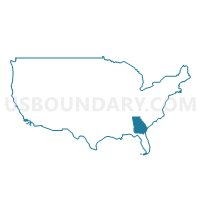
Northwest Georgia Regional Commission (Northeast) PUMA, Georgia
About
Outline
+PUMA%2c+Georgia_A280.png)
Summary
| Unique Area Identifier | 192717 |
| Name | Northwest Georgia Regional Commission (Northeast) PUMA |
| State | Georgia |
| Area (square miles) | 1,760.62 |
| Land Area (square miles) | 1,745.59 |
| Water Area (square miles) | 15.03 |
| % of Land Area | 99.15 |
| % of Water Area | 0.85 |
| Latitude of the Internal Point | 34.67424010 |
| Longtitude of the Internal Point | -84.57854130 |
Maps
Graphs
Select a template below for downloading or customizing gragh for Northwest Georgia Regional Commission (Northeast) PUMA, Georgia
+PUMA%2c+Georgia_T0.png)
+PUMA%2c+Georgia_T1.png)
+PUMA%2c+Georgia_T2.png)
+PUMA%2c+Georgia_T3.png)
+PUMA%2c+Georgia_T4.png)
+PUMA%2c+Georgia_T5.png)
+PUMA%2c+Georgia_T6.png)
+PUMA%2c+Georgia_T7.png)
Neighbors
Neighoring Public Use Microdata Area (by Name) Neighboring Public Use Microdata Area on the Map
- Atlanta Regional Commission--Cherokee County (Outside Woodstock & Canton Cities) PUMA, GA
- Bradley, McMinn & Polk Counties--Cleveland City PUMA, TN
- Georgia Mountains Regional Commission (North & Northwest) PUMA, GA
- Jackson (South), Macon, Cherokee & Clay Counties PUMA, NC
- Northwest Georgia Regional Commission (East Central)--Bartow County PUMA, GA
- Northwest Georgia Regional Commission (North Central)--Whitfield County PUMA, GA
- Northwest Georgia Regional Commission (Southwest)--Floyd, Polk & Haralson Counties PUMA, GA
- Northwest Georgia Regional Commission--Walker, Catoosa, Chattooga & Dade Counties PUMA, GA
Top 10 Neighboring County (by Population) Neighboring County on the Map
- Cherokee County, GA (214,346)
- Whitfield County, GA (102,599)
- Bartow County, GA (100,157)
- Bradley County, TN (98,963)
- Floyd County, GA (96,317)
- Walker County, GA (68,756)
- Gordon County, GA (55,186)
- Murray County, GA (39,628)
- Lumpkin County, GA (29,966)
- Pickens County, GA (29,431)
Top 10 Neighboring County Subdivision (by Population) Neighboring County Subdivision on the Map
- Dalton CCD, Whitfield County, GA (74,005)
- Calhoun CCD, Gordon County, GA (35,788)
- Chatsworth CCD, Murray County, GA (19,527)
- Dahlonega CCD, Lumpkin County, GA (16,495)
- West Whitfield CCD, Whitfield County, GA (16,086)
- District 6, Bradley County, TN (14,597)
- Blacks Mill CCD, Dawson County, GA (14,565)
- Blairsville CCD, Union County, GA (12,739)
- North Whitfield CCD, Whitfield County, GA (12,508)
- White-Pine Log CCD, Bartow County, GA (11,201)
Top 10 Neighboring Place (by Population) Neighboring Place on the Map
- Calhoun city, GA (15,650)
- Adairsville city, GA (4,648)
- Chatsworth city, GA (4,299)
- Jasper city, GA (3,684)
- Ellijay city, GA (1,619)
- Nelson city, GA (1,314)
- Blue Ridge city, GA (1,290)
- McCaysville city, GA (1,056)
- Eton city, GA (910)
- Fairmount city, GA (720)
Top 10 Neighboring Unified School District (by Population) Neighboring Unified School District on the Map
- Cherokee County School District, GA (214,346)
- Bartow County School District, GA (80,433)
- Whitfield County School District, GA (69,608)
- Walker County School District, GA (65,673)
- Floyd County School District, GA (60,014)
- Bradley County School District, TN (57,678)
- Murray County School District, GA (39,628)
- Gordon County School District, GA (39,599)
- Lumpkin County School District, GA (29,966)
- Pickens County School District, GA (29,431)
Top 10 Neighboring State Legislative District Lower Chamber (by Population) Neighboring State Legislative District Lower Chamber on the Map
- State House District 23, GA (79,982)
- State House District 21, GA (75,926)
- State House District 120, NC (72,565)
- State House District 9, GA (70,203)
- State House District 22, TN (64,839)
- State House District 14, GA (58,382)
- State House District 4, GA (56,709)
- State House District 12, GA (56,194)
- State House District 3, GA (55,830)
- State House District 7, GA (55,327)
Top 10 Neighboring State Legislative District Upper Chamber (by Population) Neighboring State Legislative District Upper Chamber on the Map
- State Senate District 27, GA (264,822)
- State Senate District 51, GA (190,842)
- State Senate District 9, TN (179,807)
- State Senate District 50, NC (175,858)
- State Senate District 54, GA (173,407)
- State Senate District 52, GA (168,885)
- State Senate District 53, GA (164,710)
Top 10 Neighboring 111th Congressional District (by Population) Neighboring 111th Congressional District on the Map
- Congressional District 9, GA (823,583)
- Congressional District 11, GA (794,969)
- Congressional District 6, GA (767,798)
- Congressional District 11, NC (703,606)
- Congressional District 3, TN (692,346)
Top 10 Neighboring Census Tract (by Population) Neighboring Census Tract on the Map
- Census Tract 9602, Bartow County, GA (10,802)
- Census Tract 102.02, Murray County, GA (9,104)
- Census Tract 9703, Gordon County, GA (8,829)
- Census Tract 804, Gilmer County, GA (8,420)
- Census Tract 901, Cherokee County, GA (8,340)
- Census Tract 902, Cherokee County, GA (7,772)
- Census Tract 9701, Dawson County, GA (7,765)
- Census Tract 12, Whitfield County, GA (7,701)
- Census Tract 9702.02, Dawson County, GA (7,535)
- Census Tract 8, Whitfield County, GA (7,352)
Top 10 Neighboring 5-Digit ZIP Code Tabulation Area (by Population) Neighboring 5-Digit ZIP Code Tabulation Area on the Map
- 30721, GA (53,601)
- 30114, GA (49,774)
- 30701, GA (40,053)
- 30165, GA (39,975)
- 30161, GA (35,058)
- 30705, GA (33,566)
- 37323, TN (30,439)
- 30720, GA (26,895)
- 30534, GA (26,685)
- 30533, GA (25,296)


+PUMA in Georgia.png)

+PUMA%2c+Georgia.png)