


Citrus County PUMA, Florida
About
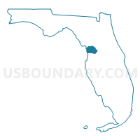
Outline

Summary
| Unique Area Identifier | 192558 |
| Name | Citrus County PUMA |
| State | Florida |
| Area (square miles) | 773.29 |
| Land Area (square miles) | 581.70 |
| Water Area (square miles) | 191.60 |
| % of Land Area | 75.22 |
| % of Water Area | 24.78 |
| Latitude of the Internal Point | 28.84362750 |
| Longtitude of the Internal Point | -82.52479640 |
Maps

Graphs
Select a template below for downloading or customizing gragh for Citrus County PUMA, Florida


Neighbors
Neighoring Public Use Microdata Area (by Name) Neighboring Public Use Microdata Area on the Map
- Columbia, Levy, Bradford, Gilchrist, Dixie & Union Counties PUMA, FL
- Hernando County PUMA, FL
- Lake (South) & Sumter (South) Counties PUMA, FL
- Marion County (North) PUMA, FL
- Marion County (South Central) PUMA, FL
- Sumter (North) & Lake (North) Counties PUMA, FL
Top 10 Neighboring County (by Population) Neighboring County on the Map
- Marion County, FL (331,298)
- Hernando County, FL (172,778)
- Citrus County, FL (141,236)
- Sumter County, FL (93,420)
- Levy County, FL (40,801)
Top 10 Neighboring County Subdivision (by Population) Neighboring County Subdivision on the Map
- Spring Hill CCD, Hernando County, FL (120,829)
- Belleview CCD, Marion County, FL (107,445)
- Crystal River CCD, Citrus County, FL (70,939)
- Inverness CCD, Citrus County, FL (70,297)
- Wildwood CCD, Sumter County, FL (68,133)
- Brooksville CCD, Hernando County, FL (32,838)
- Bushnell-Center Hill CCD, Sumter County, FL (25,287)
- Dunnellon CCD, Marion County, FL (12,354)
- Hernando Beach CCD, Hernando County, FL (12,229)
- Cedar Key-Yankeetown CCD, Levy County, FL (6,543)
Top 10 Neighboring Place (by Population) Neighboring Place on the Map
- Homosassa Springs CDP, FL (13,791)
- Pine Ridge CDP, FL (9,598)
- Hernando CDP, FL (9,054)
- Citrus Springs CDP, FL (8,622)
- Beverly Hills CDP, FL (8,445)
- Sugarmill Woods CDP, FL (8,287)
- Citrus Hills CDP, FL (7,470)
- Inverness city, FL (7,210)
- Inverness Highlands South CDP, FL (6,542)
- Lecanto CDP, FL (5,882)
Top 10 Neighboring Unified School District (by Population) Neighboring Unified School District on the Map
- Marion County School District, FL (331,298)
- Hernando County School District, FL (172,778)
- Citrus County School District, FL (141,236)
- Sumter County School District, FL (93,420)
- Levy County School District, FL (40,801)
Top 10 Neighboring State Legislative District Lower Chamber (by Population) Neighboring State Legislative District Lower Chamber on the Map
- State House District 42, FL (214,866)
- State House District 22, FL (176,739)
- State House District 44, FL (171,652)
- State House District 24, FL (166,317)
- State House District 43, FL (162,052)
Top 10 Neighboring State Legislative District Upper Chamber (by Population) Neighboring State Legislative District Upper Chamber on the Map
- State Senate District 20, FL (576,207)
- State Senate District 15, FL (560,770)
- State Senate District 3, FL (495,081)
- State Senate District 11, FL (433,661)
Top 10 Neighboring 111th Congressional District (by Population) Neighboring 111th Congressional District on the Map
Top 10 Neighboring Census Tract (by Population) Neighboring Census Tract on the Map
- Census Tract 4503.04, Citrus County, FL (9,934)
- Census Tract 4503.02, Citrus County, FL (8,622)
- Census Tract 4507.02, Citrus County, FL (7,787)
- Census Tract 4507.01, Citrus County, FL (6,868)
- Census Tract 4501.01, Citrus County, FL (6,495)
- Census Tract 4515.02, Citrus County, FL (6,488)
- Census Tract 4516.02, Citrus County, FL (6,411)
- Census Tract 27.02, Marion County, FL (6,376)
- Census Tract 4504, Citrus County, FL (6,318)
- Census Tract 4511.02, Citrus County, FL (6,174)
Top 10 Neighboring 5-Digit ZIP Code Tabulation Area (by Population) Neighboring 5-Digit ZIP Code Tabulation Area on the Map
- 34601, FL (22,336)
- 34446, FL (16,326)
- 34465, FL (15,870)
- 34442, FL (14,568)
- 34432, FL (12,273)
- 33513, FL (12,086)
- 34452, FL (11,919)
- 34448, FL (10,797)
- 34461, FL (10,562)
- 34450, FL (10,293)