


Wilson Voting District, Augusta County, Virginia
About
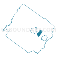
Outline

Summary
| Unique Area Identifier | 681132 |
| Name | Wilson Voting District |
| County | Augusta County |
| State | Virginia |
| Area (square miles) | 11.74 |
| Land Area (square miles) | 11.68 |
| Water Area (square miles) | 0.06 |
| % of Land Area | 99.49 |
| % of Water Area | 0.51 |
| Latitude of the Internal Point | 38.12100180 |
| Longtitude of the Internal Point | -78.97212670 |
Maps


Graphs
Select a template below for downloading or customizing gragh for Wilson Voting District, Augusta County, Virginia


Neighbors
Neighoring Voting District (by Name) Neighboring Voting District on the Map
- Expo Voting District, Augusta County, VA
- Fishersville Voting District, Augusta County, VA
- New Hope Voting District, Augusta County, VA
- Verona Voting District, Augusta County, VA
Top 10 Neighboring County Subdivision (by Population) Neighboring County Subdivision on the Map
- Wayne district, Augusta County, VA (12,187)
- Middle River district, Augusta County, VA (11,183)
- Beverley Manor district, Augusta County, VA (10,989)
Top 10 Neighboring Place (by Population) Neighboring Place on the Map
Top 10 Neighboring Unified School District (by Population) Neighboring Unified School District on the Map
Top 10 Neighboring State Legislative District Lower Chamber (by Population) Neighboring State Legislative District Lower Chamber on the Map
Top 10 Neighboring State Legislative District Upper Chamber (by Population) Neighboring State Legislative District Upper Chamber on the Map
Top 10 Neighboring 111th Congressional District (by Population) Neighboring 111th Congressional District on the Map
Top 10 Neighboring Census Tract (by Population) Neighboring Census Tract on the Map
- Census Tract 706, Augusta County, VA (9,218)
- Census Tract 707, Augusta County, VA (6,689)
- Census Tract 712, Augusta County, VA (5,980)
- Census Tract 705, Augusta County, VA (5,240)
- Census Tract 709, Augusta County, VA (4,936)