


Middlebrook Voting District, Augusta County, Virginia
About
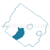
Outline

Summary
| Unique Area Identifier | 681108 |
| Name | Middlebrook Voting District |
| County | Augusta County |
| State | Virginia |
| Area (square miles) | 75.24 |
| Land Area (square miles) | 75.18 |
| Water Area (square miles) | 0.07 |
| % of Land Area | 99.91 |
| % of Water Area | 0.09 |
| Latitude of the Internal Point | 38.05909820 |
| Longtitude of the Internal Point | -79.25466800 |
Maps


Graphs
Select a template below for downloading or customizing gragh for Middlebrook Voting District, Augusta County, Virginia


Neighbors
Neighoring Voting District (by Name) Neighboring Voting District on the Map
- Buffalo Gap Voting District, Augusta County, VA
- Cedar Green Voting District, Augusta County, VA
- Craigsville Voting District, Augusta County, VA
- Goshen Voting District, Rockbridge County, VA
- Greenville Voting District, Augusta County, VA
- Rockbridge Voting District, Rockbridge County, VA
- Rockbridge Baths Voting District, Rockbridge County, VA
- Spottswood Voting District, Augusta County, VA
Top 10 Neighboring County Subdivision (by Population) Neighboring County Subdivision on the Map
- Riverheads district, Augusta County, VA (9,912)
- Pastures district, Augusta County, VA (9,772)
- Walkers Creek district, Rockbridge County, VA (5,230)
Top 10 Neighboring Place (by Population) Neighboring Place on the Map
Top 10 Neighboring Unified School District (by Population) Neighboring Unified School District on the Map
Top 10 Neighboring State Legislative District Lower Chamber (by Population) Neighboring State Legislative District Lower Chamber on the Map
Top 10 Neighboring State Legislative District Upper Chamber (by Population) Neighboring State Legislative District Upper Chamber on the Map
Top 10 Neighboring 111th Congressional District (by Population) Neighboring 111th Congressional District on the Map
Top 10 Neighboring Census Tract (by Population) Neighboring Census Tract on the Map
- Census Tract 708, Augusta County, VA (6,266)
- Census Tract 710, Augusta County, VA (5,939)
- Census Tract 709, Augusta County, VA (4,936)
- Census Tract 9302, Rockbridge County, VA (4,580)
- Census Tract 701, Augusta County, VA (3,968)
Top 10 Neighboring 5-Digit ZIP Code Tabulation Area (by Population) Neighboring 5-Digit ZIP Code Tabulation Area on the Map
- 24401, VA (35,499)
- 24440, VA (2,916)
- 24430, VA (2,643)
- 24472, VA (2,271)
- 24479, VA (1,537)
- 24439, VA (1,253)
- 24459, VA (818)