


Voting District 0029, San Patricio County, Texas
About
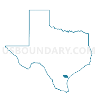
Outline

Summary
| Unique Area Identifier | 676672 |
| Name | Voting District 0029 |
| County | San Patricio County |
| State | Texas |
| Area (square miles) | 3.39 |
| Land Area (square miles) | 0.68 |
| Water Area (square miles) | 2.71 |
| % of Land Area | 19.98 |
| % of Water Area | 80.02 |
| Latitude of the Internal Point | 28.11070130 |
| Longtitude of the Internal Point | -97.86721780 |
Maps


Graphs
Select a template below for downloading or customizing gragh for Voting District 0029, San Patricio County, Texas


Neighbors
Neighoring Voting District (by Name) Neighboring Voting District on the Map
- Voting District 0001, Live Oak County, TX
- Voting District 0013, Live Oak County, TX
- Voting District 0018, San Patricio County, TX
- Voting District 0028, San Patricio County, TX
- Voting District 0030, San Patricio County, TX
Top 10 Neighboring County Subdivision (by Population) Neighboring County Subdivision on the Map
Top 10 Neighboring Place (by Population) Neighboring Place on the Map
- Lake City town, TX (509)
- Lakeshore Gardens-Hidden Acres CDP, TX (504)
- Lakeside town, TX (312)
- Paisano Park CDP, TX (130)
- Edgewater Estates CDP, TX (72)
Top 10 Neighboring Unified School District (by Population) Neighboring Unified School District on the Map
Top 10 Neighboring State Legislative District Lower Chamber (by Population) Neighboring State Legislative District Lower Chamber on the Map
Top 10 Neighboring State Legislative District Upper Chamber (by Population) Neighboring State Legislative District Upper Chamber on the Map
Top 10 Neighboring 111th Congressional District (by Population) Neighboring 111th Congressional District on the Map
Top 10 Neighboring Census Tract (by Population) Neighboring Census Tract on the Map
- Census Tract 113, San Patricio County, TX (5,111)
- Census Tract 112, San Patricio County, TX (3,060)
- Census Tract 9504, Live Oak County, TX (2,234)