


Voting District 1, Tulsa County, Oklahoma
About
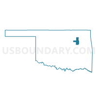
Outline

Summary
| Unique Area Identifier | 655435 |
| Name | Voting District 1 |
| County | Tulsa County |
| State | Oklahoma |
| Area (square miles) | 1.16 |
| Land Area (square miles) | 1.16 |
| Water Area (square miles) | 0.00 |
| % of Land Area | 100.00 |
| % of Water Area | 0.00 |
| Latitude of the Internal Point | 36.22975410 |
| Longtitude of the Internal Point | -95.99380870 |
Maps


Graphs
Select a template below for downloading or customizing gragh for Voting District 1, Tulsa County, Oklahoma


Neighbors
Neighoring Voting District (by Name) Neighboring Voting District on the Map
- Voting District 204, Osage County, OK
- Voting District 3, Tulsa County, OK
- Voting District 4, Tulsa County, OK
- Voting District 5, Tulsa County, OK
- Voting District 9, Tulsa County, OK
Top 10 Neighboring County Subdivision (by Population) Neighboring County Subdivision on the Map
Top 10 Neighboring Place (by Population) Neighboring Place on the Map
Top 10 Neighboring Unified School District (by Population) Neighboring Unified School District on the Map
Top 10 Neighboring State Legislative District Lower Chamber (by Population) Neighboring State Legislative District Lower Chamber on the Map
- State House District 36, OK (37,155)
- State House District 35, OK (36,242)
- State House District 73, OK (32,082)
- State House District 72, OK (31,381)
Top 10 Neighboring State Legislative District Upper Chamber (by Population) Neighboring State Legislative District Upper Chamber on the Map
Top 10 Neighboring 111th Congressional District (by Population) Neighboring 111th Congressional District on the Map
Top 10 Neighboring Census Tract (by Population) Neighboring Census Tract on the Map
- Census Tract 79, Tulsa County, OK (4,636)
- Census Tract 9400.05, Osage County, OK (3,921)
- Census Tract 80.02, Tulsa County, OK (2,791)
- Census Tract 91.01, Tulsa County, OK (2,683)