


BRIMFIELD F Voting District, Portage County, Ohio
About
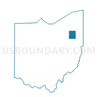
Outline

Summary
| Unique Area Identifier | 651064 |
| Name | BRIMFIELD F Voting District |
| County | Portage County |
| State | Ohio |
| Area (square miles) | 1.76 |
| Land Area (square miles) | 1.73 |
| Water Area (square miles) | 0.03 |
| % of Land Area | 98.30 |
| % of Water Area | 1.70 |
| Latitude of the Internal Point | 41.09024240 |
| Longtitude of the Internal Point | -81.35829770 |
Maps


Graphs
Select a template below for downloading or customizing gragh for BRIMFIELD F Voting District, Portage County, Ohio


Neighbors
Neighoring Voting District (by Name) Neighboring Voting District on the Map
- BRIMFIELD A Voting District, Portage County, OH
- BRIMFIELD B Voting District, Portage County, OH
- BRIMFIELD D Voting District, Portage County, OH
- BRIMFIELD E Voting District, Portage County, OH
- BRIMFIELD G Voting District, Portage County, OH