


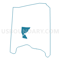
TIFFIN WEST Voting District, Adams County, Ohio
About
Outline

Summary
| Unique Area Identifier | 642454 |
| Name | TIFFIN WEST Voting District |
| County | Adams County |
| State | Ohio |
| Area (square miles) | 17.34 |
| Land Area (square miles) | 17.26 |
| Water Area (square miles) | 0.08 |
| % of Land Area | 99.54 |
| % of Water Area | 0.46 |
| Latitude of the Internal Point | 38.81642750 |
| Longtitude of the Internal Point | -83.54741710 |
Maps

Graphs
Select a template below for downloading or customizing gragh for TIFFIN WEST Voting District, Adams County, Ohio


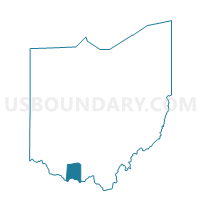
Neighbors
Neighoring Voting District (by Name) Neighboring Voting District on the Map
- LIBERTY NORTH Voting District, Adams County, OH
- LIBERTY SOUTH Voting District, Adams County, OH
- MONROE TOWNSHIP Voting District, Adams County, OH
- OLIVER TOWNSHIP Voting District, Adams County, OH
- TIFFIN EAST Voting District, Adams County, OH
- WAYNE TOWNSHIP Voting District, Adams County, OH
- WEST UNION EAST Voting District, Adams County, OH
- WEST UNION NORTH Voting District, Adams County, OH
- WEST UNION SOUTH Voting District, Adams County, OH
- WEST UNION WEST Voting District, Adams County, OH
Top 10 Neighboring County Subdivision (by Population) Neighboring County Subdivision on the Map
- Tiffin township, Adams County, OH (5,560)
- Liberty township, Adams County, OH (1,965)
- Oliver township, Adams County, OH (1,319)
- Wayne township, Adams County, OH (1,304)
- Monroe township, Adams County, OH (686)