


OLIVER TOWNSHIP Voting District, Adams County, Ohio
About
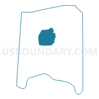
Outline

Summary
| Unique Area Identifier | 642450 |
| Name | OLIVER TOWNSHIP Voting District |
| County | Adams County |
| State | Ohio |
| Area (square miles) | 29.00 |
| Land Area (square miles) | 28.96 |
| Water Area (square miles) | 0.04 |
| % of Land Area | 99.87 |
| % of Water Area | 0.13 |
| Latitude of the Internal Point | 38.89577140 |
| Longtitude of the Internal Point | -83.49826800 |
Maps


Graphs
Select a template below for downloading or customizing gragh for OLIVER TOWNSHIP Voting District, Adams County, Ohio


Neighbors
Neighoring Voting District (by Name) Neighboring Voting District on the Map
- JACKSONVILLE Voting District, Adams County, OH
- SEAMAN PRECINCT, Adams County, OH
- TIFFIN EAST Voting District, Adams County, OH
- TIFFIN WEST Voting District, Adams County, OH
- TRANQUILITY Voting District, Adams County, OH
- WAYNE TOWNSHIP Voting District, Adams County, OH
Top 10 Neighboring County Subdivision (by Population) Neighboring County Subdivision on the Map
- Tiffin township, Adams County, OH (5,560)
- Meigs township, Adams County, OH (3,905)
- Scott township, Adams County, OH (2,180)
- Oliver township, Adams County, OH (1,319)
- Wayne township, Adams County, OH (1,304)
Top 10 Neighboring Unified School District (by Population) Neighboring Unified School District on the Map
Top 10 Neighboring State Legislative District Lower Chamber (by Population) Neighboring State Legislative District Lower Chamber on the Map
Top 10 Neighboring State Legislative District Upper Chamber (by Population) Neighboring State Legislative District Upper Chamber on the Map
Top 10 Neighboring 111th Congressional District (by Population) Neighboring 111th Congressional District on the Map
Top 10 Neighboring Census Tract (by Population) Neighboring Census Tract on the Map
- Census Tract 7703, Adams County, OH (6,964)
- Census Tract 7701, Adams County, OH (4,864)
- Census Tract 7702, Adams County, OH (4,815)
- Census Tract 7705, Adams County, OH (3,442)