


NOR021 Voting District, St. Louis County, Missouri
About
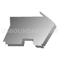
Outline

Summary
| Unique Area Identifier | 610773 |
| Name | NOR021 Voting District |
| County | St. Louis County |
| State | Missouri |
| Area (square miles) | 0.39 |
| Land Area (square miles) | 0.39 |
| Water Area (square miles) | 0.00 |
| % of Land Area | 100.00 |
| % of Water Area | 0.00 |
| Latitude of the Internal Point | 38.70935670 |
| Longtitude of the Internal Point | -90.32759210 |
Maps


Graphs
Select a template below for downloading or customizing gragh for NOR021 Voting District, St. Louis County, Missouri


Neighbors
Neighoring Voting District (by Name) Neighboring Voting District on the Map
- AP050 Voting District, St. Louis County, MO
- MID028 Voting District, St. Louis County, MO
- MID202 Voting District, St. Louis County, MO
- NOR014 Voting District, St. Louis County, MO
- NOR015 Voting District, St. Louis County, MO
- NOR020 Voting District, St. Louis County, MO
- NOR024 Voting District, St. Louis County, MO
- NOR035 Voting District, St. Louis County, MO
- NOR038 Voting District, St. Louis County, MO
- NOR044 Voting District, St. Louis County, MO
- NOR049 Voting District, St. Louis County, MO
- NOR054 Voting District, St. Louis County, MO
Top 10 Neighboring County Subdivision (by Population) Neighboring County Subdivision on the Map
- Airport township, St. Louis County, MO (35,821)
- Midland township, St. Louis County, MO (34,636)
- Normandy township, St. Louis County, MO (32,516)
Top 10 Neighboring Place (by Population) Neighboring Place on the Map
- St. John city, MO (6,517)
- Bel-Ridge village, MO (2,737)
- Bel-Nor village, MO (1,499)
- Bellerive village, MO (188)
Top 10 Neighboring Unified School District (by Population) Neighboring Unified School District on the Map
Top 10 Neighboring State Legislative District Lower Chamber (by Population) Neighboring State Legislative District Lower Chamber on the Map
Top 10 Neighboring State Legislative District Upper Chamber (by Population) Neighboring State Legislative District Upper Chamber on the Map
Top 10 Neighboring 111th Congressional District (by Population) Neighboring 111th Congressional District on the Map
Top 10 Neighboring Census Tract (by Population) Neighboring Census Tract on the Map
- Census Tract 2137, St. Louis County, MO (5,484)
- Census Tract 2135, St. Louis County, MO (4,983)
- Census Tract 2136, St. Louis County, MO (4,446)