


KC WD19 PCT1817, Jackson County, Missouri
About
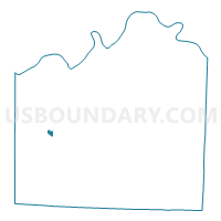
Outline

Summary
| Unique Area Identifier | 608695 |
| Name | KC WD19 PCT1817 |
| County | Jackson County |
| State | Missouri |
| Area (square miles) | 0.31 |
| Land Area (square miles) | 0.30 |
| Water Area (square miles) | 0.01 |
| % of Land Area | 96.35 |
| % of Water Area | 3.65 |
| Latitude of the Internal Point | 38.99277410 |
| Longtitude of the Internal Point | -94.51537570 |
Maps


Graphs
Select a template below for downloading or customizing gragh for KC WD19 PCT1817, Jackson County, Missouri


Neighbors
Neighoring Voting District (by Name) Neighboring Voting District on the Map
- KC WD17 PCT1706, Jackson County, MO
- KC WD17 PCT1707, Jackson County, MO
- KC WD18 PCT1806, Jackson County, MO
- KC WD19 PCT1815, Jackson County, MO
- KC WD19 PCT1903, Jackson County, MO
- KC WD19 PCT1916, Jackson County, MO