


KC WD7 PCT706, Jackson County, Missouri
About
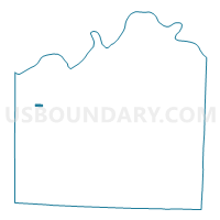
Outline

Summary
| Unique Area Identifier | 608560 |
| Name | KC WD7 PCT706 |
| County | Jackson County |
| State | Missouri |
| Area (square miles) | 0.25 |
| Land Area (square miles) | 0.25 |
| Water Area (square miles) | 0.00 |
| % of Land Area | 100.00 |
| % of Water Area | 0.00 |
| Latitude of the Internal Point | 39.04608550 |
| Longtitude of the Internal Point | -94.54486350 |
Maps


Graphs
Select a template below for downloading or customizing gragh for KC WD7 PCT706, Jackson County, Missouri


Neighbors
Neighoring Voting District (by Name) Neighboring Voting District on the Map
- KC WD15 PCT1512, Jackson County, MO
- KC WD15 PCT718, Jackson County, MO
- KC WD7 PCT703, Jackson County, MO
- KC WD7 PCT704, Jackson County, MO
- KC WD7 PCT705, Jackson County, MO
- KC WD7 PCT714, Jackson County, MO
Top 10 Neighboring County Subdivision (by Population) Neighboring County Subdivision on the Map
Top 10 Neighboring Place (by Population) Neighboring Place on the Map
Top 10 Neighboring Unified School District (by Population) Neighboring Unified School District on the Map
Top 10 Neighboring State Legislative District Lower Chamber (by Population) Neighboring State Legislative District Lower Chamber on the Map
Top 10 Neighboring State Legislative District Upper Chamber (by Population) Neighboring State Legislative District Upper Chamber on the Map
Top 10 Neighboring 111th Congressional District (by Population) Neighboring 111th Congressional District on the Map
Top 10 Neighboring Census Tract (by Population) Neighboring Census Tract on the Map
- Census Tract 171, Jackson County, MO (3,856)
- Census Tract 61, Jackson County, MO (2,542)
- Census Tract 169, Jackson County, MO (2,367)
- Census Tract 63, Jackson County, MO (1,676)
- Census Tract 60, Jackson County, MO (1,346)