


KC WD6 PCT607, Jackson County, Missouri
About
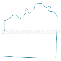
Outline

Summary
| Unique Area Identifier | 608510 |
| Name | KC WD6 PCT607 |
| County | Jackson County |
| State | Missouri |
| Area (square miles) | 0.21 |
| Land Area (square miles) | 0.21 |
| Water Area (square miles) | 0.00 |
| % of Land Area | 100.00 |
| % of Water Area | 0.00 |
| Latitude of the Internal Point | 39.03829870 |
| Longtitude of the Internal Point | -94.60438180 |
Maps


Graphs
Select a template below for downloading or customizing gragh for KC WD6 PCT607, Jackson County, Missouri


Neighbors
Neighoring Voting District (by Name) Neighboring Voting District on the Map
- KC WD5 PCT506, Jackson County, MO
- KC WD5 PCT507, Jackson County, MO
- KC WD6 PCT606, Jackson County, MO
- KC WD6 PCT608, Jackson County, MO
- Mission Hills 0-01 Voting District, Johnson County, KS
- Mission Woods 0-01 Voting District, Johnson County, KS
- Westwood 0-01 Voting District, Johnson County, KS
- Westwood Hills 0-01 Voting District, Johnson County, KS
Top 10 Neighboring County Subdivision (by Population) Neighboring County Subdivision on the Map
- Kaw township, Jackson County, MO (170,129)
- Mission Hills city, Johnson County, KS (3,498)
- Westwood city, Johnson County, KS (1,506)
- Westwood Hills city, Johnson County, KS (359)
- Mission Woods city, Johnson County, KS (178)
Top 10 Neighboring Place (by Population) Neighboring Place on the Map
- Kansas City city, MO (459,787)
- Mission Hills city, KS (3,498)
- Westwood city, KS (1,506)
- Westwood Hills city, KS (359)
- Mission Woods city, KS (178)
Top 10 Neighboring Unified School District (by Population) Neighboring Unified School District on the Map
- Shawnee Mission Public Schools Unified School District, KS (219,161)
- Kansas City School District, MO (194,122)
Top 10 Neighboring State Legislative District Lower Chamber (by Population) Neighboring State Legislative District Lower Chamber on the Map
- State House District 44, MO (32,845)
- State House District 39, MO (32,519)
- State House District 25, KS (20,461)
Top 10 Neighboring State Legislative District Upper Chamber (by Population) Neighboring State Legislative District Upper Chamber on the Map
Top 10 Neighboring 111th Congressional District (by Population) Neighboring 111th Congressional District on the Map
Top 10 Neighboring Census Tract (by Population) Neighboring Census Tract on the Map
- Census Tract 500, Johnson County, KS (4,688)
- Census Tract 71, Jackson County, MO (2,847)
- Census Tract 72, Jackson County, MO (1,892)