


KC WD10 PCT1012, Jackson County, Missouri
About
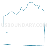
Outline

Summary
| Unique Area Identifier | 608319 |
| Name | KC WD10 PCT1012 |
| County | Jackson County |
| State | Missouri |
| Area (square miles) | 0.11 |
| Land Area (square miles) | 0.11 |
| Water Area (square miles) | 0.00 |
| % of Land Area | 100.00 |
| % of Water Area | 0.00 |
| Latitude of the Internal Point | 38.95594750 |
| Longtitude of the Internal Point | -94.56369410 |
Maps


Graphs
Select a template below for downloading or customizing gragh for KC WD10 PCT1012, Jackson County, Missouri


Neighbors
Neighoring Voting District (by Name) Neighboring Voting District on the Map
- KC WD10 PCT1010, Jackson County, MO
- KC WD10 PCT1011, Jackson County, MO
- KC WD10 PCT1013, Jackson County, MO
- KC WD10 PCT1014, Jackson County, MO
- KC WD19 PCT1910, Jackson County, MO
- KC WD19 PCT1919, Jackson County, MO