


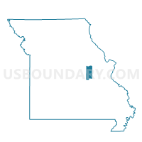
Boulware Voting District, Gasconade County, Missouri
About
Outline

Summary
| Unique Area Identifier | 607844 |
| Name | Boulware Voting District |
| County | Gasconade County |
| State | Missouri |
| Area (square miles) | 67.94 |
| Land Area (square miles) | 67.38 |
| Water Area (square miles) | 0.56 |
| % of Land Area | 99.18 |
| % of Water Area | 0.82 |
| Latitude of the Internal Point | 38.49972530 |
| Longtitude of the Internal Point | -91.56085170 |
Maps


Graphs
Select a template below for downloading or customizing gragh for Boulware Voting District, Gasconade County, Missouri


Neighbors
Neighoring Voting District (by Name) Neighboring Voting District on the Map
- Cooper Hill Voting District, Osage County, MO
- Drake Voting District, Gasconade County, MO
- Freedom Voting District, Osage County, MO
- Little Berger Voting District, Gasconade County, MO
- Morrison Ward Nos. 1 & 2 & Rural, Gasconade County, MO
- Rural Canaan Voting District, Gasconade County, MO
- Stolpe/Gasconade Voting District, Gasconade County, MO
- Swiss Voting District, Gasconade County, MO
- Third Creek Voting District, Gasconade County, MO
Top 10 Neighboring County Subdivision (by Population) Neighboring County Subdivision on the Map
- Canaan township, Gasconade County, MO (5,339)
- Crawford township, Osage County, MO (4,445)
- Roark township, Gasconade County, MO (3,774)
- Jefferson township, Osage County, MO (1,249)
- Boeuf township, Gasconade County, MO (1,087)
- Richland township, Gasconade County, MO (857)
- Third Creek township, Gasconade County, MO (666)
- Boulware township, Gasconade County, MO (642)
Top 10 Neighboring Unified School District (by Population) Neighboring Unified School District on the Map
- Gasconade County R-II School District, MO (11,820)
- Gasconade County R-I School District, MO (7,671)
- Osage County R-II School District, MO (5,310)
Top 10 Neighboring State Legislative District Lower Chamber (by Population) Neighboring State Legislative District Lower Chamber on the Map
Top 10 Neighboring State Legislative District Upper Chamber (by Population) Neighboring State Legislative District Upper Chamber on the Map
Top 10 Neighboring 111th Congressional District (by Population) Neighboring 111th Congressional District on the Map
Top 10 Neighboring Census Tract (by Population) Neighboring Census Tract on the Map
- Census Tract 4902, Osage County, MO (4,433)
- Census Tract 9603, Gasconade County, MO (2,887)
- Census Tract 4904, Osage County, MO (2,528)
- Census Tract 9602, Gasconade County, MO (1,926)
Top 10 Neighboring 5-Digit ZIP Code Tabulation Area (by Population) Neighboring 5-Digit ZIP Code Tabulation Area on the Map
- 65066, MO (6,703)
- 65041, MO (5,725)
- 65051, MO (4,874)
- 65014, MO (2,252)
- 65061, MO (746)
- 65062, MO (49)