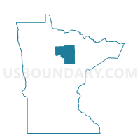
Warba Voting District, Itasca County, Minnesota
About
Outline
Summary
| Unique Area Identifier | 602621 |
| Name | Warba Voting District |
| County | Itasca County |
| State | Minnesota |
| Area (square miles) | 3.27 |
| Land Area (square miles) | 3.21 |
| Water Area (square miles) | 0.05 |
| % of Land Area | 98.32 |
| % of Water Area | 1.68 |
| Latitude of the Internal Point | 47.13563120 |
| Longtitude of the Internal Point | -93.27007950 |
Maps

Graphs
Select a template below for downloading or customizing gragh for Warba Voting District, Itasca County, Minnesota