


WASHINGTON TWP Voting District, Dallas County, Iowa
About
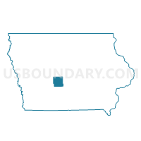
Outline

Summary
| Unique Area Identifier | 581916 |
| Name | WASHINGTON TWP Voting District |
| County | Dallas County |
| State | Iowa |
| Area (square miles) | 36.64 |
| Land Area (square miles) | 36.31 |
| Water Area (square miles) | 0.34 |
| % of Land Area | 99.08 |
| % of Water Area | 0.92 |
| Latitude of the Internal Point | 41.73561790 |
| Longtitude of the Internal Point | -94.09653330 |
Maps


Graphs
Select a template below for downloading or customizing gragh for WASHINGTON TWP Voting District, Dallas County, Iowa


Neighbors
Neighoring Voting District (by Name) Neighboring Voting District on the Map
- ADEL TWP PART W/O ADEL & DALLAS CENTER Voting District, Dallas County, IA
- BEAVER TWP Voting District, Dallas County, IA
- COLFAX TWP Voting District, Dallas County, IA
- DALLAS TWP Voting District, Dallas County, IA
- LINCOLN TWP Voting District, Dallas County, IA
- LINN TWP W/O LINDEN Voting District, Dallas County, IA
- SPRING VALLEY TWP Voting District, Dallas County, IA
- SUGAR GROVE TWP W/O DALLAS CENTER Voting District, Dallas County, IA
Top 10 Neighboring County Subdivision (by Population) Neighboring County Subdivision on the Map
- Spring Valley township, Dallas County, IA (8,333)
- Adel township, Dallas County, IA (5,997)
- Sugar Grove township, Dallas County, IA (927)
- Linn township, Dallas County, IA (539)
- Beaver township, Dallas County, IA (468)
- Colfax township, Dallas County, IA (399)
- Dallas township, Dallas County, IA (345)
- Washington township, Dallas County, IA (331)
- Lincoln township, Dallas County, IA (234)
Top 10 Neighboring Unified School District (by Population) Neighboring Unified School District on the Map
- Dallas Center-Grimes Community School District, IA (9,527)
- Perry Community School District, IA (9,469)
- Adel-De Soto-Minburn Community School District, IA (7,832)
- West Central Valley Community School District, IA (5,805)
Top 10 Neighboring State Legislative District Lower Chamber (by Population) Neighboring State Legislative District Lower Chamber on the Map
Top 10 Neighboring State Legislative District Upper Chamber (by Population) Neighboring State Legislative District Upper Chamber on the Map
Top 10 Neighboring 111th Congressional District (by Population) Neighboring 111th Congressional District on the Map
Top 10 Neighboring Census Tract (by Population) Neighboring Census Tract on the Map
Top 10 Neighboring 5-Digit ZIP Code Tabulation Area (by Population) Neighboring 5-Digit ZIP Code Tabulation Area on the Map
- 50220, IA (9,020)
- 50003, IA (6,594)
- 50063, IA (2,604)
- 50233, IA (1,388)
- 50167, IA (748)
- 50039, IA (329)