


DALLAS TWP Voting District, Dallas County, Iowa
About
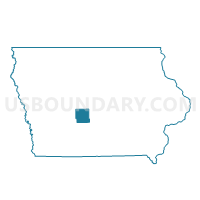
Outline

Summary
| Unique Area Identifier | 581905 |
| Name | DALLAS TWP Voting District |
| County | Dallas County |
| State | Iowa |
| Area (square miles) | 35.93 |
| Land Area (square miles) | 35.67 |
| Water Area (square miles) | 0.26 |
| % of Land Area | 99.29 |
| % of Water Area | 0.71 |
| Latitude of the Internal Point | 41.81282930 |
| Longtitude of the Internal Point | -94.23179560 |
Maps


Graphs
Select a template below for downloading or customizing gragh for DALLAS TWP Voting District, Dallas County, Iowa


Neighbors
Neighoring Voting District (by Name) Neighboring Voting District on the Map
- CASS TWP W/O YALE Voting District, Guthrie County, IA
- FRANKLIN TWP Voting District, Greene County, IA
- LINCOLN TWP Voting District, Dallas County, IA
- RICHLAND TWP W/O YALE Voting District, Guthrie County, IA
- SPRING VALLEY TWP Voting District, Dallas County, IA
- UNION TWP W/O BERKLEY Voting District, Boone County, IA
- WASHINGTON TWP Voting District, Dallas County, IA
- WASHINGTON TWP Voting District, Greene County, IA
Top 10 Neighboring County Subdivision (by Population) Neighboring County Subdivision on the Map
- Spring Valley township, Dallas County, IA (8,333)
- Cass township, Guthrie County, IA (2,410)
- Washington township, Greene County, IA (502)
- Richland township, Guthrie County, IA (493)
- Union township, Boone County, IA (466)
- Dallas township, Dallas County, IA (345)
- Washington township, Dallas County, IA (331)
- Lincoln township, Dallas County, IA (234)
- Franklin township, Greene County, IA (158)
Top 10 Neighboring Place (by Population) Neighboring Place on the Map
Top 10 Neighboring Unified School District (by Population) Neighboring Unified School District on the Map
- Perry Community School District, IA (9,469)
- Adel-De Soto-Minburn Community School District, IA (7,832)
- Panorama Community School District, IA (4,664)
- East Greene Community School District, IA (1,803)
Top 10 Neighboring State Legislative District Lower Chamber (by Population) Neighboring State Legislative District Lower Chamber on the Map
- State House District 47, IA (54,425)
- State House District 48, IA (29,258)
- State House District 58, IA (27,255)
- State House District 50, IA (25,121)
Top 10 Neighboring State Legislative District Upper Chamber (by Population) Neighboring State Legislative District Upper Chamber on the Map
- State Senate District 24, IA (83,683)
- State Senate District 29, IA (54,648)
- State Senate District 25, IA (54,046)
Top 10 Neighboring 111th Congressional District (by Population) Neighboring 111th Congressional District on the Map
Top 10 Neighboring Census Tract (by Population) Neighboring Census Tract on the Map
- Census Tract 9501, Guthrie County, IA (4,296)
- Census Tract 802, Greene County, IA (2,575)
- Census Tract 206, Boone County, IA (2,283)
- Census Tract 505, Dallas County, IA (2,117)
- Census Tract 801, Greene County, IA (2,059)