


BLACK 03, Posey County, Indiana
About
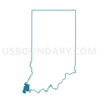
Outline

Summary
| Unique Area Identifier | 580183 |
| Name | BLACK 03 |
| County | Posey County |
| State | Indiana |
| Area (square miles) | 24.07 |
| Land Area (square miles) | 23.35 |
| Water Area (square miles) | 0.72 |
| % of Land Area | 97.02 |
| % of Water Area | 2.98 |
| Latitude of the Internal Point | 37.92532820 |
| Longtitude of the Internal Point | -87.97252680 |
Maps


Graphs
Select a template below for downloading or customizing gragh for BLACK 03, Posey County, Indiana


Neighbors
Neighoring Voting District (by Name) Neighboring Voting District on the Map
- BLACK 01, Posey County, IN
- BLACK 02, Posey County, IN
- BLACK 04, Posey County, IN
- BLACK 07, Posey County, IN
- BLACK 08, Posey County, IN
- BLACK 09, Posey County, IN
- BLACK 10, Posey County, IN
- BLACK 11, Posey County, IN
- BLACK 12, Posey County, IN
- EMMA 30 Voting District, White County, IL
- POINT, Posey County, IN
Top 10 Neighboring County Subdivision (by Population) Neighboring County Subdivision on the Map
- Black township, Posey County, IN (9,450)
- Corydon CCD, Henderson County, KY (7,314)
- Uniontown CCD, Union County, KY (1,751)
- Emma township, White County, IL (387)
- Point township, Posey County, IN (381)
Top 10 Neighboring Place (by Population) Neighboring Place on the Map
Top 10 Neighboring Unified School District (by Population) Neighboring Unified School District on the Map
- Henderson County School District, KY (46,250)
- Mount Vernon Metropolitan School District, IN (15,903)
- Union County School District, KY (15,007)
- Carmi-White County Community Unit School District 5, IL (9,282)
Top 10 Neighboring State Legislative District Lower Chamber (by Population) Neighboring State Legislative District Lower Chamber on the Map
- State House District 118, IL (99,068)
- State House District 76, IN (59,647)
- State House District 7, KY (39,972)
- State House District 11, KY (39,906)
Top 10 Neighboring State Legislative District Upper Chamber (by Population) Neighboring State Legislative District Upper Chamber on the Map
- State Senate District 59, IL (209,843)
- State Senate District 49, IN (113,960)
- State Senate District 4, KY (106,696)
Top 10 Neighboring 111th Congressional District (by Population) Neighboring 111th Congressional District on the Map
- Congressional District 8, IN (694,398)
- Congressional District 1, KY (686,989)
- Congressional District 15, IL (681,580)
Top 10 Neighboring Census Tract (by Population) Neighboring Census Tract on the Map
- Census Tract 209, Henderson County, KY (7,314)
- Census Tract 406, Posey County, IN (3,474)
- Census Tract 405, Posey County, IN (3,317)
- Census Tract 9584, White County, IL (3,316)
- Census Tract 407, Posey County, IN (2,912)
- Census Tract 9501, Union County, KY (1,751)