


INDIAN CREEK, Monroe County, Indiana
About
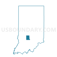
Outline

Summary
| Unique Area Identifier | 579775 |
| Name | INDIAN CREEK |
| County | Monroe County |
| State | Indiana |
| Area (square miles) | 35.10 |
| Land Area (square miles) | 35.07 |
| Water Area (square miles) | 0.03 |
| % of Land Area | 99.91 |
| % of Water Area | 0.09 |
| Latitude of the Internal Point | 39.05025540 |
| Longtitude of the Internal Point | -86.62643660 |
Maps


Graphs
Select a template below for downloading or customizing gragh for INDIAN CREEK, Monroe County, Indiana


Neighbors
Neighoring Voting District (by Name) Neighboring Voting District on the Map
- BEECH CREEK 02, Greene County, IN
- CENTER 02, Greene County, IN
- CLEAR CREEK 01, Monroe County, IN
- JACKSON, Greene County, IN
- MARSHALL 01, Lawrence County, IN
- PERRY, Lawrence County, IN
- PERRY 25, Monroe County, IN
- VAN BUREN 04, Monroe County, IN
- VAN BUREN 05, Monroe County, IN
Top 10 Neighboring County Subdivision (by Population) Neighboring County Subdivision on the Map
- Perry township, Monroe County, IN (50,673)
- Van Buren township, Monroe County, IN (11,981)
- Clear Creek township, Monroe County, IN (5,000)
- Marshall township, Lawrence County, IN (4,660)
- Center township, Greene County, IN (3,535)
- Beech Creek township, Greene County, IN (2,595)
- Perry township, Lawrence County, IN (2,259)
- Jackson township, Greene County, IN (1,947)
- Indian Creek township, Monroe County, IN (1,634)
Top 10 Neighboring Place (by Population) Neighboring Place on the Map
Top 10 Neighboring Unified School District (by Population) Neighboring Unified School District on the Map
- Monroe County Community School Corporation, IN (120,715)
- North Lawrence Community Schools, IN (34,125)
- Eastern Greene County School District, IN (8,077)
Top 10 Neighboring State Legislative District Lower Chamber (by Population) Neighboring State Legislative District Lower Chamber on the Map
- State House District 60, IN (70,940)
- State House District 65, IN (64,454)
- State House District 62, IN (60,681)
Top 10 Neighboring State Legislative District Upper Chamber (by Population) Neighboring State Legislative District Upper Chamber on the Map
- State Senate District 40, IN (139,764)
- State Senate District 39, IN (126,383)
- State Senate District 44, IN (123,667)
Top 10 Neighboring 111th Congressional District (by Population) Neighboring 111th Congressional District on the Map
- Congressional District 4, IN (789,835)
- Congressional District 9, IN (729,076)
- Congressional District 8, IN (694,398)
Top 10 Neighboring Census Tract (by Population) Neighboring Census Tract on the Map
- Census Tract 9506, Lawrence County, IN (7,284)
- Census Tract 12, Monroe County, IN (5,898)
- Census Tract 9547.01, Greene County, IN (4,587)
- Census Tract 11.03, Monroe County, IN (3,161)
- Census Tract 15.02, Monroe County, IN (2,724)