


WASHINGTON, Monroe County, Indiana
About
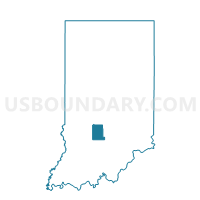
Outline

Summary
| Unique Area Identifier | 579761 |
| Name | WASHINGTON |
| County | Monroe County |
| State | Indiana |
| Area (square miles) | 34.24 |
| Land Area (square miles) | 34.23 |
| Water Area (square miles) | 0.01 |
| % of Land Area | 99.96 |
| % of Water Area | 0.04 |
| Latitude of the Internal Point | 39.30104870 |
| Longtitude of the Internal Point | -86.50562610 |
Maps


Graphs
Select a template below for downloading or customizing gragh for WASHINGTON, Monroe County, Indiana


Neighbors
Neighoring Voting District (by Name) Neighboring Voting District on the Map
- BAKER, Morgan County, IN
- BEAN BLOSSOM 02, Monroe County, IN
- BENTON 01, Monroe County, IN
- BLOOMINGTON 12, Monroe County, IN
- BLOOMINGTON 15, Monroe County, IN
- WASHINGTON 7, Morgan County, IN
Top 10 Neighboring County Subdivision (by Population) Neighboring County Subdivision on the Map
- Bloomington township, Monroe County, IN (44,167)
- Washington township, Morgan County, IN (17,073)
- Benton township, Monroe County, IN (3,358)
- Bean Blossom township, Monroe County, IN (2,916)
- Washington township, Monroe County, IN (2,029)
- Baker township, Morgan County, IN (717)
Top 10 Neighboring Unified School District (by Population) Neighboring Unified School District on the Map
- Monroe County Community School Corporation, IN (120,715)
- Martinsville Schools Metropolitan School District, IN (30,507)
- Richland-Bean Blossom Community School Corporation, IN (17,259)
Top 10 Neighboring State Legislative District Lower Chamber (by Population) Neighboring State Legislative District Lower Chamber on the Map
- State House District 60, IN (70,940)
- State House District 61, IN (67,665)
- State House District 46, IN (63,864)
- State House District 47, IN (62,157)
Top 10 Neighboring State Legislative District Upper Chamber (by Population) Neighboring State Legislative District Upper Chamber on the Map
Top 10 Neighboring 111th Congressional District (by Population) Neighboring 111th Congressional District on the Map
Top 10 Neighboring Census Tract (by Population) Neighboring Census Tract on the Map
- Census Tract 5110, Morgan County, IN (7,342)
- Census Tract 13.01, Monroe County, IN (5,648)
- Census Tract 14.02, Monroe County, IN (5,216)
- Census Tract 5107.01, Morgan County, IN (3,489)
- Census Tract 7, Monroe County, IN (2,905)
- Census Tract 14.01, Monroe County, IN (2,029)
Top 10 Neighboring 5-Digit ZIP Code Tabulation Area (by Population) Neighboring 5-Digit ZIP Code Tabulation Area on the Map
- 46151, IN (30,921)
- 47408, IN (24,776)
- 47404, IN (21,026)
- 47429, IN (7,986)
- 47433, IN (4,025)
- 47468, IN (1,250)