


PRECINCT 66, Delaware County, Indiana
About
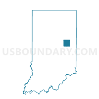
Outline

Summary
| Unique Area Identifier | 576914 |
| Name | PRECINCT 66 |
| County | Delaware County |
| State | Indiana |
| Area (square miles) | 1.03 |
| Land Area (square miles) | 1.02 |
| Water Area (square miles) | 0.00 |
| % of Land Area | 99.66 |
| % of Water Area | 0.34 |
| Latitude of the Internal Point | 40.30142280 |
| Longtitude of the Internal Point | -85.23511820 |
Maps


Graphs
Select a template below for downloading or customizing gragh for PRECINCT 66, Delaware County, Indiana


Neighbors
Neighoring Voting District (by Name) Neighboring Voting District on the Map
- GREEN, Randolph County, IN
- PRECINCT 65, Delaware County, IN
- PRECINCT 67, Delaware County, IN
- SOUTH REDKEY, Jay County, IN
Top 10 Neighboring County Subdivision (by Population) Neighboring County Subdivision on the Map
- Richland township, Jay County, IN (4,518)
- Delaware township, Delaware County, IN (3,603)
- Niles township, Delaware County, IN (1,360)
- Green township, Randolph County, IN (957)
Top 10 Neighboring Place (by Population) Neighboring Place on the Map
Top 10 Neighboring Unified School District (by Population) Neighboring Unified School District on the Map
- Jay School Corporation, IN (21,253)
- Delaware Community School Corporation, IN (15,007)
- Monroe Central School Corporation, IN (5,658)
Top 10 Neighboring State Legislative District Lower Chamber (by Population) Neighboring State Legislative District Lower Chamber on the Map
Top 10 Neighboring State Legislative District Upper Chamber (by Population) Neighboring State Legislative District Upper Chamber on the Map
Top 10 Neighboring 111th Congressional District (by Population) Neighboring 111th Congressional District on the Map
Top 10 Neighboring Census Tract (by Population) Neighboring Census Tract on the Map
- Census Tract 27, Delaware County, IN (4,963)
- Census Tract 9515, Randolph County, IN (3,091)
- Census Tract 9632, Jay County, IN (2,676)