


PRECINCT 62, Delaware County, Indiana
About
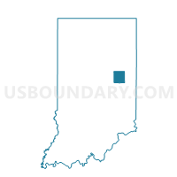
Outline

Summary
| Unique Area Identifier | 576912 |
| Name | PRECINCT 62 |
| County | Delaware County |
| State | Indiana |
| Area (square miles) | 30.16 |
| Land Area (square miles) | 28.25 |
| Water Area (square miles) | 1.92 |
| % of Land Area | 93.65 |
| % of Water Area | 6.35 |
| Latitude of the Internal Point | 40.11319140 |
| Longtitude of the Internal Point | -85.26240800 |
Maps


Graphs
Select a template below for downloading or customizing gragh for PRECINCT 62, Delaware County, Indiana


Neighbors
Neighoring Voting District (by Name) Neighboring Voting District on the Map
- PRAIRIE 01, Henry County, IN
- PRECINCT 41, Delaware County, IN
- PRECINCT 73, Delaware County, IN
- PRECINCT 75, Delaware County, IN
- STONEY CREEK, Henry County, IN
- STONEY CREEK, Randolph County, IN
- UNION, Randolph County, IN
Top 10 Neighboring County Subdivision (by Population) Neighboring County Subdivision on the Map
- Center township, Delaware County, IN (69,199)
- Prairie township, Henry County, IN (5,517)
- Liberty township, Delaware County, IN (4,685)
- Monroe township, Delaware County, IN (3,729)
- Union township, Randolph County, IN (2,142)
- Perry township, Delaware County, IN (1,511)
- Stoney Creek township, Randolph County, IN (990)
- Stoney Creek township, Henry County, IN (817)
Top 10 Neighboring Unified School District (by Population) Neighboring Unified School District on the Map
- Muncie Community Schools, IN (69,199)
- Blue River Valley Schools, IN (6,739)
- Liberty-Perry Community School Corporation, IN (6,196)
- Monroe Central School Corporation, IN (5,658)
- Cowan Community School Corporation, IN (3,729)
- Union School Corporation, IN (2,959)
Top 10 Neighboring State Legislative District Lower Chamber (by Population) Neighboring State Legislative District Lower Chamber on the Map
- State House District 54, IN (63,197)
- State House District 35, IN (62,848)
- State House District 34, IN (59,305)
- State House District 33, IN (58,513)
Top 10 Neighboring State Legislative District Upper Chamber (by Population) Neighboring State Legislative District Upper Chamber on the Map
- State Senate District 28, IN (171,077)
- State Senate District 26, IN (119,532)
- State Senate District 27, IN (116,341)
Top 10 Neighboring 111th Congressional District (by Population) Neighboring 111th Congressional District on the Map
Top 10 Neighboring Census Tract (by Population) Neighboring Census Tract on the Map
- Census Tract 22, Delaware County, IN (6,196)
- Census Tract 9519, Randolph County, IN (4,529)
- Census Tract 9756, Henry County, IN (4,215)
- Census Tract 23.01, Delaware County, IN (3,729)
- Census Tract 9521, Randolph County, IN (3,023)
- Census Tract 21, Delaware County, IN (2,798)