


Weld 100, Weld County, Colorado
About
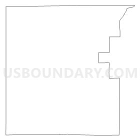
Outline
Summary
| Unique Area Identifier | 549392 |
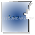
| Name | Weld 100 |
| County | Weld County |
| State | Colorado |
| Area (square miles) | 530.64 |
| Land Area (square miles) | 530.47 |
| Water Area (square miles) | 0.17 |
| % of Land Area | 99.97 |
| % of Water Area | 0.03 |
| Latitude of the Internal Point | 40.81757270 |
| Longtitude of the Internal Point | -104.74270140 |
Maps


Graphs
Select a template below for downloading or customizing gragh for Weld 100, Weld County, Colorado


Neighbors
Neighoring Voting District (by Name) Neighboring Voting District on the Map
- CARPENTER FIRE STATION Voting District, Laramie County, WY
- LARAMIE COUNTY COMMUNITY COLLEGE Voting District, Laramie County, WY
- LARAMIE COUNTY COMMUNITY COLLEGE Voting District, Laramie County, WY
- Larimer 404, Larimer County, CO
- Larimer 425, Larimer County, CO
- Larimer 432, Larimer County, CO
- Weld 101, Weld County, CO
- Weld 103, Weld County, CO
- Weld 104, Weld County, CO
- Weld 126, Weld County, CO
- WILLADSEN ELEMENTARY SCHOOL Voting District, Laramie County, WY
Top 10 Neighboring County Subdivision (by Population) Neighboring County Subdivision on the Map
- Timnath-Wellington CCD, Larimer County, CO (18,311)
- Cheyenne East CCD, Laramie County, WY (8,642)
- Cheyenne West CCD, Laramie County, WY (7,254)
- Ault CCD, Weld County, CO (6,601)
- Kersey-Gill CCD, Weld County, CO (6,033)
- Grover CCD, Weld County, CO (521)
Top 10 Neighboring Place (by Population) Neighboring Place on the Map
Top 10 Neighboring Unified School District (by Population) Neighboring Unified School District on the Map
- Poudre School District R-1, CO (184,648)
- Laramie County School District 1, WY (86,198)
- Eaton School District RE-2, CO (9,648)
- Ault-Highland School District RE-9, CO (5,588)
- Laramie County School District 2, WY (5,540)
- Pawnee School District RE-12, CO (522)
Top 10 Neighboring State Legislative District Lower Chamber (by Population) Neighboring State Legislative District Lower Chamber on the Map
- State House District 49, CO (83,740)
- State House District 65, CO (77,293)
- State House District 43, WY (10,800)
- State House District 10, WY (10,403)
- State House District 12, WY (9,810)
Top 10 Neighboring State Legislative District Upper Chamber (by Population) Neighboring State Legislative District Upper Chamber on the Map
- State Senate District 13, CO (159,077)
- State Senate District 15, CO (155,929)
- State Senate District 6, WY (19,877)
- State Senate District 7, WY (18,950)
- State Senate District 8, WY (18,717)
Top 10 Neighboring 111th Congressional District (by Population) Neighboring 111th Congressional District on the Map
Top 10 Neighboring Census Tract (by Population) Neighboring Census Tract on the Map
- Census Tract 25.02, Larimer County, CO (8,118)
- Census Tract 25.01, Larimer County, CO (7,573)
- Census Tract 20, Laramie County, WY (7,130)
- Census Tract 25.01, Weld County, CO (4,843)
- Census Tract 23, Weld County, CO (4,619)
- Census Tract 19.02, Laramie County, WY (4,182)
- Census Tract 25.03, Larimer County, CO (2,620)
Top 10 Neighboring 5-Digit ZIP Code Tabulation Area (by Population) Neighboring 5-Digit ZIP Code Tabulation Area on the Map
- 80524, CO (31,668)
- 82007, WY (19,096)
- 80549, CO (8,642)
- 80615, CO (7,482)
- 80610, CO (2,791)
- 80650, CO (1,432)
- 80648, CO (1,001)
- 82054, WY (920)
- 80729, CO (540)
- 80612, CO (430)