


Weld 304, Weld County, Colorado
About
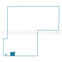
Outline

Summary
| Unique Area Identifier | 549381 |
| Name | Weld 304 |
| County | Weld County |
| State | Colorado |
| Area (square miles) | 32.52 |
| Land Area (square miles) | 32.26 |
| Water Area (square miles) | 0.27 |
| % of Land Area | 99.18 |
| % of Water Area | 0.82 |
| Latitude of the Internal Point | 40.04070150 |
| Longtitude of the Internal Point | -104.80907480 |
Maps


Graphs
Select a template below for downloading or customizing gragh for Weld 304, Weld County, Colorado


Neighbors
Neighoring Voting District (by Name) Neighboring Voting District on the Map
- Adams 167, Adams County, CO
- Adams 168, Adams County, CO
- Adams 172, Adams County, CO
- Adams 174, Adams County, CO
- Adams 183, Adams County, CO
- Weld 300, Weld County, CO
- Weld 301, Weld County, CO
- Weld 302, Weld County, CO
- Weld 303, Weld County, CO
- Weld 313, Weld County, CO
- Weld 314, Weld County, CO
Top 10 Neighboring County Subdivision (by Population) Neighboring County Subdivision on the Map
- Brighton CCD, Adams County, CO (80,401)
- Keenesburg-Hudson CCD, Weld County, CO (13,399)
- Fort Lupton CCD, Weld County, CO (11,599)
Top 10 Neighboring Place (by Population) Neighboring Place on the Map
- Brighton city, CO (33,352)
- Fort Lupton city, CO (7,377)
- Lochbuie town, CO (4,726)
- Todd Creek CDP, CO (3,768)
Top 10 Neighboring Unified School District (by Population) Neighboring Unified School District on the Map
- Brighton School District 27J, CO (77,537)
- Keenesburg School District RE-3J, CO (12,643)
- Weld County School District RE-8, CO (12,408)
Top 10 Neighboring State Legislative District Lower Chamber (by Population) Neighboring State Legislative District Lower Chamber on the Map
- State House District 48, CO (112,104)
- State House District 31, CO (100,635)
- State House District 30, CO (82,192)
- State House District 65, CO (77,293)
Top 10 Neighboring State Legislative District Upper Chamber (by Population) Neighboring State Legislative District Upper Chamber on the Map
Top 10 Neighboring 111th Congressional District (by Population) Neighboring 111th Congressional District on the Map
Top 10 Neighboring Census Tract (by Population) Neighboring Census Tract on the Map
- Census Tract 19.02, Weld County, CO (7,743)
- Census Tract 85.42, Adams County, CO (7,036)
- Census Tract 85.43, Adams County, CO (6,935)
- Census Tract 86.04, Adams County, CO (4,923)
- Census Tract 19.05, Weld County, CO (4,322)
- Census Tract 85.41, Adams County, CO (4,277)
- Census Tract 19.08, Weld County, CO (3,000)
- Census Tract 19.07, Weld County, CO (2,775)
- Census Tract 86.03, Adams County, CO (2,055)