


Weld 300, Weld County, Colorado
About
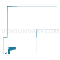
Outline

Summary
| Unique Area Identifier | 549377 |
| Name | Weld 300 |
| County | Weld County |
| State | Colorado |
| Area (square miles) | 55.99 |
| Land Area (square miles) | 55.73 |
| Water Area (square miles) | 0.25 |
| % of Land Area | 99.55 |
| % of Water Area | 0.45 |
| Latitude of the Internal Point | 40.08787280 |
| Longtitude of the Internal Point | -104.84373540 |
Maps


Graphs
Select a template below for downloading or customizing gragh for Weld 300, Weld County, Colorado


Neighbors
Neighoring Voting District (by Name) Neighboring Voting District on the Map
- Adams 163, Adams County, CO
- Adams 168, Adams County, CO
- Weld 202, Weld County, CO
- Weld 203, Weld County, CO
- Weld 205, Weld County, CO
- Weld 237, Weld County, CO
- Weld 240, Weld County, CO
- Weld 301, Weld County, CO
- Weld 304, Weld County, CO
- Weld 305, Weld County, CO
- Weld 309, Weld County, CO
Top 10 Neighboring County Subdivision (by Population) Neighboring County Subdivision on the Map
- Brighton CCD, Adams County, CO (80,401)
- Erie-Frederick CCD, Weld County, CO (37,786)
- Keenesburg-Hudson CCD, Weld County, CO (13,399)
- Fort Lupton CCD, Weld County, CO (11,599)
- Platteville CCD, Weld County, CO (4,222)
Top 10 Neighboring Place (by Population) Neighboring Place on the Map
- Thornton city, CO (118,772)
- Firestone town, CO (10,147)
- Frederick town, CO (8,679)
- Fort Lupton city, CO (7,377)
- Dacono city, CO (4,152)
- Todd Creek CDP, CO (3,768)
- Aristocrat Ranchettes CDP, CO (1,344)
Top 10 Neighboring Unified School District (by Population) Neighboring Unified School District on the Map
- St. Vrain Valley School District RE 1J, CO (151,981)
- Brighton School District 27J, CO (77,537)
- Keenesburg School District RE-3J, CO (12,643)
- Weld County School District RE-8, CO (12,408)
- Weld County School District RE-1, CO (8,930)
Top 10 Neighboring State Legislative District Lower Chamber (by Population) Neighboring State Legislative District Lower Chamber on the Map
- State House District 48, CO (112,104)
- State House District 31, CO (100,635)
- State House District 65, CO (77,293)
Top 10 Neighboring State Legislative District Upper Chamber (by Population) Neighboring State Legislative District Upper Chamber on the Map
- State Senate District 23, CO (188,398)
- State Senate District 25, CO (181,050)
- State Senate District 24, CO (156,797)
Top 10 Neighboring 111th Congressional District (by Population) Neighboring 111th Congressional District on the Map
- Congressional District 2, CO (733,805)
- Congressional District 4, CO (725,041)
- Congressional District 7, CO (678,410)
Top 10 Neighboring Census Tract (by Population) Neighboring Census Tract on the Map
- Census Tract 19.02, Weld County, CO (7,743)
- Census Tract 19.05, Weld County, CO (4,322)
- Census Tract 85.41, Adams County, CO (4,277)
- Census Tract 18, Weld County, CO (4,222)
- Census Tract 20.04, Weld County, CO (3,729)
- Census Tract 20.16, Weld County, CO (3,023)
- Census Tract 19.08, Weld County, CO (3,000)
- Census Tract 19.07, Weld County, CO (2,775)
- Census Tract 19.06, Weld County, CO (1,502)
- Census Tract 20.14, Weld County, CO (1,455)
Top 10 Neighboring 5-Digit ZIP Code Tabulation Area (by Population) Neighboring 5-Digit ZIP Code Tabulation Area on the Map
- 80504, CO (46,876)
- 80602, CO (27,665)
- 80621, CO (12,079)
- 80603, CO (11,973)
- 80514, CO (4,106)
- 80530, CO (3,790)