


Weld 129, Weld County, Colorado
About
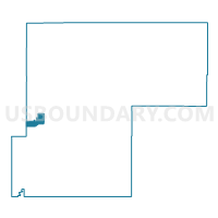
Outline

Summary
| Unique Area Identifier | 549351 |
| Name | Weld 129 |
| County | Weld County |
| State | Colorado |
| Area (square miles) | 19.44 |
| Land Area (square miles) | 19.38 |
| Water Area (square miles) | 0.06 |
| % of Land Area | 99.69 |
| % of Water Area | 0.31 |
| Latitude of the Internal Point | 40.43691710 |
| Longtitude of the Internal Point | -104.86542960 |
Maps


Graphs
Select a template below for downloading or customizing gragh for Weld 129, Weld County, Colorado


Neighbors
Neighoring Voting District (by Name) Neighboring Voting District on the Map
- Larimer 441, Larimer County, CO
- Larimer 504, Larimer County, CO
- Weld 120, Weld County, CO
- Weld 121, Weld County, CO
- Weld 124, Weld County, CO
- Weld 125, Weld County, CO
- Weld 130, Weld County, CO
- Weld 131, Weld County, CO
- Weld 138, Weld County, CO
- Weld 213, Weld County, CO
- Weld 232, Weld County, CO
- Weld 243, Weld County, CO
- Weld 244, Weld County, CO
Top 10 Neighboring County Subdivision (by Population) Neighboring County Subdivision on the Map
- Greeley CCD, Weld County, CO (122,755)
- Loveland CCD, Larimer County, CO (95,583)
- Johnstown-Milliken CCD, Weld County, CO (25,317)
- Windsor CCD, Weld County, CO (19,286)
Top 10 Neighboring Place (by Population) Neighboring Place on the Map
Top 10 Neighboring Unified School District (by Population) Neighboring Unified School District on the Map
- Thompson School District R-2J, CO (104,236)
- Windsor School District RE-4, CO (21,510)
- Johnstown-Milliken School District RE-5J, CO (16,550)
Top 10 Neighboring State Legislative District Lower Chamber (by Population) Neighboring State Legislative District Lower Chamber on the Map
- State House District 48, CO (112,104)
- State House District 49, CO (83,740)
- State House District 51, CO (80,253)
- State House District 65, CO (77,293)
Top 10 Neighboring State Legislative District Upper Chamber (by Population) Neighboring State Legislative District Upper Chamber on the Map
- State Senate District 23, CO (188,398)
- State Senate District 13, CO (159,077)
- State Senate District 15, CO (155,929)
Top 10 Neighboring 111th Congressional District (by Population) Neighboring 111th Congressional District on the Map
Top 10 Neighboring Census Tract (by Population) Neighboring Census Tract on the Map
- Census Tract 17.09, Larimer County, CO (11,580)
- Census Tract 21.02, Weld County, CO (9,989)
- Census Tract 21.01, Weld County, CO (7,319)
- Census Tract 15, Weld County, CO (6,547)
- Census Tract 22.08, Weld County, CO (4,588)
- Census Tract 14.12, Weld County, CO (2,309)
- Census Tract 14.16, Weld County, CO (1,999)
- Census Tract 22.09, Weld County, CO (904)
- Census Tract 22.03, Weld County, CO (893)
- Census Tract 22.10, Weld County, CO (783)
Top 10 Neighboring 5-Digit ZIP Code Tabulation Area (by Population) Neighboring 5-Digit ZIP Code Tabulation Area on the Map
- 80634, CO (52,861)
- 80631, CO (48,603)
- 80538, CO (43,930)
- 80550, CO (20,675)
- 80534, CO (11,301)
- 80543, CO (5,887)