


Weld 118, Weld County, Colorado
About
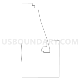
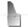
Outline
Summary
| Unique Area Identifier | 549341 |
| Name | Weld 118 |
| County | Weld County |
| State | Colorado |
| Area (square miles) | 13.41 |
| Land Area (square miles) | 13.41 |
| Water Area (square miles) | 0.00 |
| % of Land Area | 100.00 |
| % of Water Area | 0.00 |
| Latitude of the Internal Point | 40.53110010 |
| Longtitude of the Internal Point | -104.73051780 |
Maps

Graphs
Select a template below for downloading or customizing gragh for Weld 118, Weld County, Colorado


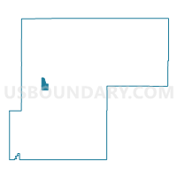
Neighbors
Neighoring Voting District (by Name) Neighboring Voting District on the Map
- Weld 119, Weld County, CO
- Weld 127, Weld County, CO
- Weld 128, Weld County, CO
- Weld 131, Weld County, CO