


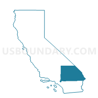
Voting District 44685, San Bernardino County, California
About
Outline

Summary
| Unique Area Identifier | 539223 |
| Name | Voting District 44685 |
| County | San Bernardino County |
| State | California |
| Area (square miles) | 0.08 |
| Land Area (square miles) | 0.08 |
| Water Area (square miles) | 0.00 |
| % of Land Area | 100.00 |
| % of Water Area | 0.00 |
| Latitude of the Internal Point | 33.92950440 |
| Longtitude of the Internal Point | -117.65687080 |
Maps


Graphs
Select a template below for downloading or customizing gragh for Voting District 44685, San Bernardino County, California


Neighbors
Neighoring Voting District (by Name) Neighboring Voting District on the Map
- Voting District 21615, Riverside County, CA
- Voting District 44600, San Bernardino County, CA
- Voting District 44675, San Bernardino County, CA
Top 10 Neighboring County Subdivision (by Population) Neighboring County Subdivision on the Map
Top 10 Neighboring Place (by Population) Neighboring Place on the Map
Top 10 Neighboring Unified School District (by Population) Neighboring Unified School District on the Map
- Corona-Norco Unified School District, CA (256,162)
- Chino Valley Unified School District, CA (172,848)
Top 10 Neighboring State Legislative District Lower Chamber (by Population) Neighboring State Legislative District Lower Chamber on the Map
- Assembly District 71, CA (543,864)
- Assembly District 61, CA (441,000)
- Assembly District 60, CA (439,072)
Top 10 Neighboring State Legislative District Upper Chamber (by Population) Neighboring State Legislative District Upper Chamber on the Map
Top 10 Neighboring 111th Congressional District (by Population) Neighboring 111th Congressional District on the Map
Top 10 Neighboring Census Tract (by Population) Neighboring Census Tract on the Map
- Census Tract 1.16, San Bernardino County, CA (10,856)
- Census Tract 406.09, Riverside County, CA (8,422)
- Census Tract 19.03, San Bernardino County, CA (8,028)
- Census Tract 1.15, San Bernardino County, CA (7,114)