


Manitowoc & Kewaunee Counties PUMA, Wisconsin
About
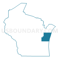
Outline

Summary
| Unique Area Identifier | 194406 |
| Name | Manitowoc & Kewaunee Counties PUMA |
| State | Wisconsin |
| Area (square miles) | 2,578.37 |
| Land Area (square miles) | 931.60 |
| Water Area (square miles) | 1,646.77 |
| % of Land Area | 36.13 |
| % of Water Area | 63.87 |
| Latitude of the Internal Point | 44.10465120 |
| Longtitude of the Internal Point | -87.31057130 |
Maps

Graphs
Select a template below for downloading or customizing gragh for Manitowoc & Kewaunee Counties PUMA, Wisconsin


Neighbors
Neighoring Public Use Microdata Area (by Name) Neighboring Public Use Microdata Area on the Map
- Fond du Lac & Calumet Counties PUMA, WI
- Marinette, Oconto, Door & Florence Counties PUMA, WI
- Newaygo, Mason, Oceana & Lake Counties PUMA, MI
- Northwest Lower Peninsula (West) PUMA, MI
- Outer Green Bay City PUMA, WI
- Sheboygan County PUMA, WI
Top 10 Neighboring County (by Population) Neighboring County on the Map
- Brown County, WI (248,007)
- Sheboygan County, WI (115,507)
- Manitowoc County, WI (81,442)
- Calumet County, WI (48,971)
- Mason County, MI (28,705)
- Door County, WI (27,785)
- Manistee County, MI (24,733)
- Kewaunee County, WI (20,574)
- Benzie County, MI (17,525)
Top 10 Neighboring County Subdivision (by Population) Neighboring County Subdivision on the Map
- Manitowoc city, Manitowoc County, WI (33,736)
- Two Rivers city, Manitowoc County, WI (11,712)
- Kiel city, Manitowoc County, WI (3,429)
- Algoma city, Kewaunee County, WI (3,167)
- Brillion city, Calumet County, WI (3,148)
- Kewaunee city, Kewaunee County, WI (2,952)
- Luxemburg village, Kewaunee County, WI (2,515)
- Newton town, Manitowoc County, WI (2,264)
- Herman town, Sheboygan County, WI (2,151)
- Manitowoc Rapids town, Manitowoc County, WI (2,150)
Top 10 Neighboring Place (by Population) Neighboring Place on the Map
- Manitowoc city, WI (33,736)
- Two Rivers city, WI (11,712)
- Kiel city, WI (3,738)
- Algoma city, WI (3,167)
- Brillion city, WI (3,148)
- Kewaunee city, WI (2,952)
- Luxemburg village, WI (2,515)
- Cleveland village, WI (1,485)
- Mishicot village, WI (1,442)
- Reedsville village, WI (1,206)
Top 10 Neighboring Unified School District (by Population) Neighboring Unified School District on the Map
- Sheboygan Area School District, WI (61,046)
- Manitowoc School District, WI (39,517)
- Two Rivers School District, WI (13,042)
- Manistee Area Schools, MI (12,921)
- Luxemburg-Casco School District, WI (11,083)
- New Holstein School District, WI (9,402)
- Denmark School District, WI (8,356)
- Kiel Area School District, WI (8,289)
- Southern Door County School District, WI (8,044)
- Mason County Central Schools, MI (7,804)
Top 10 Neighboring State Legislative District Lower Chamber (by Population) Neighboring State Legislative District Lower Chamber on the Map
- State House District 101, MI (92,671)
- Assembly District 3, WI (65,789)
- Assembly District 2, WI (61,009)
- Assembly District 59, WI (58,836)
- Assembly District 27, WI (56,118)
- Assembly District 1, WI (54,189)
- Assembly District 25, WI (53,380)
Top 10 Neighboring State Legislative District Upper Chamber (by Population) Neighboring State Legislative District Upper Chamber on the Map
- State Senate District 34, MI (275,923)
- State Senate District 35, MI (261,943)
- State Senate District 1, WI (180,989)
- State Senate District 20, WI (176,381)
- State Senate District 9, WI (162,219)
Top 10 Neighboring 111th Congressional District (by Population) Neighboring 111th Congressional District on the Map
- Congressional District 8, WI (706,840)
- Congressional District 6, WI (705,102)
- Congressional District 2, MI (698,831)
Top 10 Neighboring Census Tract (by Population) Neighboring Census Tract on the Map
- Census Tract 9604, Kewaunee County, WI (8,589)
- Census Tract 104, Manitowoc County, WI (6,182)
- Census Tract 9605, Kewaunee County, WI (6,176)
- Census Tract 7, Manitowoc County, WI (5,901)
- Census Tract 102, Manitowoc County, WI (5,891)
- Census Tract 207.02, Brown County, WI (5,884)
- Census Tract 201, Brown County, WI (5,645)
- Census Tract 3, Manitowoc County, WI (5,615)
- Census Tract 6, Manitowoc County, WI (5,369)
- Census Tract 1, Manitowoc County, WI (5,236)
Top 10 Neighboring 5-Digit ZIP Code Tabulation Area (by Population) Neighboring 5-Digit ZIP Code Tabulation Area on the Map
- 54220, WI (40,220)
- 53083, WI (20,362)
- 54235, WI (17,203)
- 54241, WI (14,884)
- 53014, WI (7,962)
- 54217, WI (7,405)
- 53042, WI (6,690)
- 54216, WI (6,276)
- 54208, WI (6,061)
- 54201, WI (5,345)