


Charlotte County PUMA, Florida
About
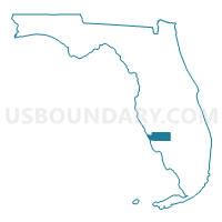
Outline

Summary
| Unique Area Identifier | 192557 |
| Name | Charlotte County PUMA |
| State | Florida |
| Area (square miles) | 858.30 |
| Land Area (square miles) | 680.28 |
| Water Area (square miles) | 178.02 |
| % of Land Area | 79.26 |
| % of Water Area | 20.74 |
| Latitude of the Internal Point | 26.86882590 |
| Longtitude of the Internal Point | -81.94085830 |
Maps

Graphs
Select a template below for downloading or customizing gragh for Charlotte County PUMA, Florida


Neighbors
Neighoring Public Use Microdata Area (by Name) Neighboring Public Use Microdata Area on the Map
- Lee County (Northeast)--Lehigh Acres & North Fort Myers PUMA, FL
- Lee County (Northwest)--Cape Coral City PUMA, FL
- Lee County (South & West)--Barrier Islands Region PUMA, FL
- Sarasota County (Central & Gulf Coast) PUMA, FL
- Sarasota County (East) PUMA, FL
- Southeast Heartland--Highlands (South & East), Okeechobee, Hendry & Glades Counties PUMA, FL
- Southwest Heartland--Highlands (Northwest), DeSoto & Hardee Counties PUMA, FL
Top 10 Neighboring County (by Population) Neighboring County on the Map
- Lee County, FL (618,754)
- Sarasota County, FL (379,448)
- Charlotte County, FL (159,978)
- Highlands County, FL (98,786)
- Hendry County, FL (39,140)
- DeSoto County, FL (34,862)
- Glades County, FL (12,884)
Top 10 Neighboring County Subdivision (by Population) Neighboring County Subdivision on the Map
- Cape Coral CCD, Lee County, FL (168,049)
- Port Charlotte CCD, Charlotte County, FL (83,428)
- North Port CCD, Sarasota County, FL (61,969)
- Grove City-Rotonda CCD, Charlotte County, FL (38,309)
- Punta Gorda CCD, Charlotte County, FL (38,241)
- North Fort Myers CCD, Lee County, FL (36,609)
- Interior County CCD, Sarasota County, FL (29,743)
- Lake Placid CCD, Highlands County, FL (25,220)
- Arcadia East CCD, DeSoto County, FL (23,251)
- LaBelle CCD, Hendry County, FL (19,246)
Top 10 Neighboring Place (by Population) Neighboring Place on the Map
- North Port city, FL (57,357)
- Port Charlotte CDP, FL (54,392)
- North Fort Myers CDP, FL (39,407)
- Punta Gorda city, FL (16,641)
- Englewood CDP, FL (14,863)
- Rotonda CDP, FL (8,759)
- Charlotte Harbor CDP, FL (3,714)
- Cleveland CDP, FL (2,990)
- Harbour Heights CDP, FL (2,987)
- Charlotte Park CDP, FL (2,325)
Top 10 Neighboring Unified School District (by Population) Neighboring Unified School District on the Map
- Lee County School District, FL (618,754)
- Sarasota County School District, FL (379,448)
- Charlotte County School District, FL (159,978)
- Highlands County School District, FL (98,786)
- Hendry County School District, FL (39,140)
- DeSoto County School District, FL (34,862)
- Glades County School District, FL (12,884)
Top 10 Neighboring State Legislative District Lower Chamber (by Population) Neighboring State Legislative District Lower Chamber on the Map
- State House District 71, FL (183,147)
- State House District 74, FL (182,460)
- State House District 72, FL (167,184)
- State House District 70, FL (150,125)
- State House District 77, FL (147,455)
Top 10 Neighboring State Legislative District Upper Chamber (by Population) Neighboring State Legislative District Upper Chamber on the Map
- State Senate District 27, FL (551,555)
- State Senate District 21, FL (529,870)
- State Senate District 39, FL (483,183)
- State Senate District 23, FL (458,330)
- State Senate District 17, FL (456,960)
Top 10 Neighboring 111th Congressional District (by Population) Neighboring 111th Congressional District on the Map
- Congressional District 14, FL (858,956)
- Congressional District 16, FL (797,711)
- Congressional District 13, FL (757,805)
Top 10 Neighboring Census Tract (by Population) Neighboring Census Tract on the Map
- Census Tract 27.12, Sarasota County, FL (33,041)
- Census Tract 27.11, Sarasota County, FL (9,348)
- Census Tract 204, Charlotte County, FL (8,006)
- Census Tract 101.02, Lee County, FL (7,674)
- Census Tract 302, Charlotte County, FL (7,493)
- Census Tract 202.01, Charlotte County, FL (7,396)
- Census Tract 105.02, Charlotte County, FL (7,025)
- Census Tract 2, Glades County, FL (6,870)
- Census Tract 201.01, Charlotte County, FL (6,824)
- Census Tract 202.02, Charlotte County, FL (6,627)
Top 10 Neighboring 5-Digit ZIP Code Tabulation Area (by Population) Neighboring 5-Digit ZIP Code Tabulation Area on the Map
- 34293, FL (33,001)
- 34266, FL (31,055)
- 33917, FL (28,666)
- 33952, FL (28,382)
- 34287, FL (23,859)
- 33950, FL (20,699)
- 33993, FL (20,628)
- 33935, FL (20,383)
- 34286, FL (17,970)
- 34223, FL (16,875)