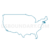
Congressional District 6, Massachusetts
About
** Data sources from census 2010 **
Maps
Graphs
Neighbors
Neighoring 111th Congressional District (by Name) Neighboring 111th Congressional District on the Map
- Congressional District 1, NH
- Congressional District 5, MA
- Congressional District 7, MA
- Congressional District 8, MA
Top 10 Neighboring County (by Population) Neighboring County on the Map
- Middlesex County, MA (1,503,085)
- Essex County, MA (743,159)
- Suffolk County, MA (722,023)
- Rockingham County, NH (295,223)
Top 10 Neighboring County Subdivision (by Population) Neighboring County Subdivision on the Map
- Boston city, Suffolk County, MA (617,594)
- Lynn city, Essex County, MA (90,329)
- Lawrence city, Essex County, MA (76,377)
- Haverhill city, Essex County, MA (60,879)
- Malden city, Middlesex County, MA (59,450)
- Revere city, Suffolk County, MA (51,755)
- Peabody city, Essex County, MA (51,251)
- Methuen Town city, Essex County, MA (47,255)
- Salem city, Essex County, MA (41,340)
- Billerica town, Middlesex County, MA (40,243)
Top 10 Neighboring Place (by Population) Neighboring Place on the Map
- Boston city, MA (617,594)
- Lynn city, MA (90,329)
- Lawrence city, MA (76,377)
- Haverhill city, MA (60,879)
- Malden city, MA (59,450)
- Revere city, MA (51,755)
- Peabody city, MA (51,251)
- Methuen Town city, MA (47,255)
- Salem city, MA (41,340)
- Beverly city, MA (39,502)
Top 10 Neighboring Elementary School District (by Population) Neighboring Elementary School District on the Map
- Concord School District, MA (17,668)
- Middleton School District, MA (8,987)
- Seabrook School District, NH (8,693)
- Boxford School District, MA (7,965)
- Lincoln School District, MA (6,362)
- Topsfield School District, MA (6,085)
- Carlisle School District, MA (4,852)
- Nahant School District, MA (3,410)
- South Hampton School District, NH (814)
Top 10 Neighboring Secondary School District (by Population) Neighboring Secondary School District on the Map
- Winnacunnet Cooperative School District, NH (30,660)
- Lincoln-Sudbury School District, MA (24,021)
- Masconomet School District, MA (23,037)
- Concord-Carlisle School District, MA (22,520)
- Swampscott School District in Nahant (7-12), MA (3,410)
Top 10 Neighboring Unified School District (by Population) Neighboring Unified School District on the Map
- Boston School District, MA (617,594)
- Lynn School District, MA (90,329)
- Lawrence School District, MA (76,377)
- Haverhill School District, MA (60,879)
- Malden School District, MA (59,450)
- Revere School District, MA (51,755)
- Peabody School District, MA (51,251)
- Methuen School District, MA (47,255)
- Salem School District, MA (41,340)
- Billerica School District, MA (40,243)
Top 10 Neighboring State Legislative District Lower Chamber (by Population) Neighboring State Legislative District Lower Chamber on the Map
- Sixteenth Suffolk District, MA (43,906)
- Twelfth Essex District, MA (43,860)
- Twentieth Middlesex District, MA (43,378)
- Fifteenth Essex District, MA (43,123)
- Fourteenth Essex District, MA (42,299)
- Seventeenth Essex District, MA (42,166)
- Second Essex District, MA (42,019)
- First Essex District, MA (41,982)
- Ninth Essex District, MA (41,963)
- Eighteenth Essex District, MA (41,945)
Top 10 Neighboring State Legislative District Upper Chamber (by Population) Neighboring State Legislative District Upper Chamber on the Map
- First Suffolk & Middlesex District, MA (174,180)
- First Essex District, MA (170,805)
- First Essex & Middlesex District, MA (169,764)
- Middlesex, Suffolk & Essex District, MA (168,830)
- Second Essex & Middlesex District, MA (167,996)
- Third Middlesex District, MA (165,996)
- Second Essex District, MA (164,671)
- Middlesex & Essex District, MA (161,537)
- Fourth Middlesex District, MA (161,112)
- Third Essex & Middlesex District, MA (154,037)
Top 10 Neighboring Census Tract (by Population) Neighboring Census Tract on the Map
- Census Tract 2103, Essex County, MA (9,110)
- Census Tract 1703, Suffolk County, MA (9,040)
- Census Tract 2121, Essex County, MA (8,987)
- Census Tract 2176, Essex County, MA (8,679)
- Census Tract 3322, Middlesex County, MA (8,376)
- Census Tract 3301, Middlesex County, MA (8,231)
- Census Tract 3163, Middlesex County, MA (8,172)
- Census Tract 3419.02, Middlesex County, MA (8,120)
- Census Tract 2131, Essex County, MA (7,961)
- Census Tract 3155, Middlesex County, MA (7,722)
Top 10 Neighboring 5-Digit ZIP Code Tabulation Area (by Population) Neighboring 5-Digit ZIP Code Tabulation Area on the Map
- 02148, MA (59,503)
- 02151, MA (51,808)
- 01960, MA (50,944)
- 01844, MA (47,249)
- 01841, MA (47,225)
- 01902, MA (45,139)
- 01970, MA (41,109)
- 01915, MA (39,502)
- 01801, MA (38,903)
- 01810, MA (33,201)


