


Congressional District (at Large), Delaware
About
%2c+Delaware_A280.png)
** Data sources from census 2010 **
Maps

 in Delaware.png)
Graphs
%2c+Delaware_T0.png)
%2c+Delaware_T1.png)
%2c+Delaware_T2.png)
%2c+Delaware_T3.png)
%2c+Delaware_T4.png)
%2c+Delaware_T5.png)
%2c+Delaware_T6.png)
%2c+Delaware_T7.png)
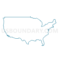
%2c+Delaware.png)
Neighbors
Neighoring 111th Congressional District (by Name) Neighboring 111th Congressional District on the Map
- Congressional District 1, MD
- Congressional District 1, NJ
- Congressional District 16, PA
- Congressional District 2, NJ
- Congressional District 7, PA
Top 10 Neighboring County (by Population) Neighboring County on the Map
- Delaware County, PA (558,979)
- New Castle County, DE (538,479)
- Chester County, PA (498,886)
- Gloucester County, NJ (288,288)
- Sussex County, DE (197,145)
- Kent County, DE (162,310)
- Cumberland County, NJ (156,898)
- Cecil County, MD (101,108)
- Wicomico County, MD (98,733)
- Cape May County, NJ (97,265)
Top 10 Neighboring County Subdivision (by Population) Neighboring County Subdivision on the Map
- New Castle CCD, New Castle County, DE (86,227)
- Brandywine CCD, New Castle County, DE (77,182)
- Dover CCD, Kent County, DE (77,165)
- Wilmington CCD, New Castle County, DE (70,851)
- Newark CCD, New Castle County, DE (68,723)
- Middletown-Odessa CCD, New Castle County, DE (52,453)
- Pike Creek-Central Kirkwood CCD, New Castle County, DE (42,016)
- Glasgow CCD, New Castle County, DE (39,748)
- Lower Christiana CCD, New Castle County, DE (36,558)
- Selbyville-Frankford CCD, Sussex County, DE (30,510)
Top 10 Neighboring Place (by Population) Neighboring Place on the Map
- Wilmington city, DE (70,851)
- Dover city, DE (36,047)
- Newark city, DE (31,454)
- Bear CDP, DE (19,371)
- Middletown town, DE (18,871)
- Elkton town, MD (15,443)
- Brookside CDP, DE (14,353)
- Glasgow CDP, DE (14,303)
- Hockessin CDP, DE (13,527)
- Pennsville CDP, NJ (11,888)
Top 10 Neighboring Elementary School District (by Population) Neighboring Elementary School District on the Map
- Logan Township School District, NJ (6,042)
- Oldmans Township School District, NJ (1,773)
- Lower Alloways Creek Township School District, NJ (1,770)
- Elsinboro Township School District, NJ (1,036)
Top 10 Neighboring Unified School District (by Population) Neighboring Unified School District on the Map
- Christina School District, DE (170,139)
- Red Clay Consolidated School District, DE (138,228)
- Cecil County Public Schools, MD (101,108)
- Wicomico County Public Schools, MD (98,733)
- Brandywine School District, DE (88,179)
- Colonial School District, DE (82,345)
- Indian River School District, DE (74,395)
- Capital School District, DE (54,739)
- Appoquinimink School District, DE (53,855)
- Worcester County Public Schools, MD (51,454)
Top 10 Neighboring State Legislative District Lower Chamber (by Population) Neighboring State Legislative District Lower Chamber on the Map
- General Assembly District 3, NJ (235,440)
- State Legislative District 36, MD (137,167)
- State Legislative Subdistrict 38B, MD (88,842)
- State Legislative Subdistrict 37B, MD (86,699)
- State House District 160, PA (73,500)
- State House District 158, PA (68,769)
- State House District 159, PA (55,766)
- State Legislative Subdistrict 34B, MD (46,394)
- State Legislative Subdistrict 37A, MD (42,590)
- State House District 8, DE (34,905)
Top 10 Neighboring State Legislative District Upper Chamber (by Population) Neighboring State Legislative District Upper Chamber on the Map
- State Senate District 9, PA (277,401)
- State Senate District 3, NJ (235,440)
- State Senate District 36, MD (137,167)
- State Senate District 38, MD (134,633)
- State Senate District 34, MD (131,492)
- State Senate District 37, MD (129,289)
- State Senate District 14, DE (59,548)
- State Senate District 18, DE (54,015)
- State Senate District 15, DE (51,296)
- State Senate District 16, DE (50,103)
Top 10 Neighboring Census Tract (by Population) Neighboring Census Tract on the Map
- Census Tract 402.02, Kent County, DE (12,763)
- Census Tract 166.04, New Castle County, DE (11,407)
- Census Tract 166.01, New Castle County, DE (11,362)
- Census Tract 148.05, New Castle County, DE (10,215)
- Census Tract 422.01, Kent County, DE (9,766)
- Census Tract 418.01, Kent County, DE (9,633)
- Census Tract 4103.02, Delaware County, PA (8,947)
- Census Tract 422.02, Kent County, DE (8,857)
- Census Tract 4104, Delaware County, PA (8,791)
- Census Tract 107.02, Wicomico County, MD (8,671)
Top 10 Neighboring 5-Digit ZIP Code Tabulation Area (by Population) Neighboring 5-Digit ZIP Code Tabulation Area on the Map
- 19720, DE (59,250)
- 19702, DE (51,899)
- 19711, DE (51,322)
- 21921, MD (44,471)
- 19805, DE (40,937)
- 19701, DE (39,194)
- 19808, DE (38,442)
- 19709, DE (35,107)
- 19901, DE (35,055)
- 19904, DE (34,132)