


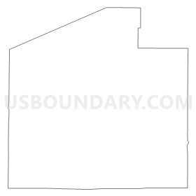
BURNS COMMUNITY CENTER Voting District, Laramie County, Wyoming
About
Outline
Summary
| Unique Area Identifier | 698704 |
| Name | BURNS COMMUNITY CENTER Voting District |
| County | Laramie County |
| State | Wyoming |
| Area (square miles) | 282.07 |
| Land Area (square miles) | 282.04 |
| Water Area (square miles) | 0.03 |
| % of Land Area | 99.99 |
| % of Water Area | 0.01 |
| Latitude of the Internal Point | 41.27909710 |
| Longtitude of the Internal Point | -104.41616060 |
Maps


Graphs
Select a template below for downloading or customizing gragh for BURNS COMMUNITY CENTER Voting District, Laramie County, Wyoming


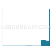
Neighbors
Neighoring Voting District (by Name) Neighboring Voting District on the Map
- ALBIN COMMUNITY CENTER Voting District, Laramie County, WY
- ARCHER RESEARCH STATION Voting District, Laramie County, WY
- CARPENTER FIRE STATION Voting District, Laramie County, WY
- LARAMIE COUNTY COMMUNITY COLLEGE Voting District, Laramie County, WY
- PETSCH FEDDLOT OFFICE Voting District, Laramie County, WY
- PINE BLUFFS COMMUNITY CENTER Voting District, Laramie County, WY
- SHRINE CLUB Voting District, Laramie County, WY
Top 10 Neighboring County Subdivision (by Population) Neighboring County Subdivision on the Map
Top 10 Neighboring Place (by Population) Neighboring Place on the Map
Top 10 Neighboring Unified School District (by Population) Neighboring Unified School District on the Map
Top 10 Neighboring State Legislative District Lower Chamber (by Population) Neighboring State Legislative District Lower Chamber on the Map
- State House District 43, WY (10,800)
- State House District 10, WY (10,403)
- State House District 7, WY (10,209)
Top 10 Neighboring State Legislative District Upper Chamber (by Population) Neighboring State Legislative District Upper Chamber on the Map
- State Senate District 6, WY (19,877)
- State Senate District 7, WY (18,950)
- State Senate District 4, WY (18,513)
Top 10 Neighboring 111th Congressional District (by Population) Neighboring 111th Congressional District on the Map
Top 10 Neighboring Census Tract (by Population) Neighboring Census Tract on the Map
Top 10 Neighboring 5-Digit ZIP Code Tabulation Area (by Population) Neighboring 5-Digit ZIP Code Tabulation Area on the Map
- 82009, WY (31,703)
- 82007, WY (19,096)
- 82082, WY (1,606)
- 82053, WY (1,524)
- 82054, WY (920)
- 82050, WY (401)
- 82060, WY (372)