


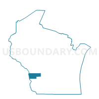
WHEATLAND - T 1 Voting District, Vernon County, Wisconsin
About

** Data sources from census 2010 **
Maps


Graphs


Neighbors
Neighoring Voting District (by Name) Neighboring Voting District on the Map
- De Solo - V 1 Voting District, Vernon County, WI
- De Soto - V 1 Voting District, Crawford County, WI
- FREEMAN - T 1 Voting District, Crawford County, WI
- GENOA - T 1 Voting District, Vernon County, WI
- GENOA - T 2 Voting District, Vernon County, WI
- IOWA TWP Voting District, Allamakee County, IA
- LANSING TWP Voting District, Allamakee County, IA
- STERLING - T 1 Voting District, Vernon County, WI
Top 10 Neighboring County Subdivision (by Population) Neighboring County Subdivision on the Map
- Lansing township, Allamakee County, IA (1,424)
- Genoa town, Vernon County, WI (789)
- Iowa township, Allamakee County, IA (744)
- Freeman town, Crawford County, WI (686)
- Sterling town, Vernon County, WI (633)
- Wheatland town, Vernon County, WI (561)
- De Soto village, Vernon County, WI (179)
- De Soto village, Crawford County, WI (108)
Top 10 Neighboring Place (by Population) Neighboring Place on the Map
Top 10 Neighboring Unified School District (by Population) Neighboring Unified School District on the Map
Top 10 Neighboring State Legislative District Lower Chamber (by Population) Neighboring State Legislative District Lower Chamber on the Map
Top 10 Neighboring State Legislative District Upper Chamber (by Population) Neighboring State Legislative District Upper Chamber on the Map
Top 10 Neighboring 111th Congressional District (by Population) Neighboring 111th Congressional District on the Map
Top 10 Neighboring Census Tract (by Population) Neighboring Census Tract on the Map
- Census Tract 9607, Vernon County, WI (4,017)
- Census Tract 9605, Vernon County, WI (3,507)
- Census Tract 9602, Allamakee County, IA (2,591)
- Census Tract 9602, Crawford County, WI (2,291)
- Census Tract 9601, Allamakee County, IA (2,130)