


Brushy Creek Voting District, Pickens County, South Carolina
About
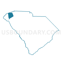
Outline

Summary
| Unique Area Identifier | 666528 |
| Name | Brushy Creek Voting District |
| County | Pickens County |
| State | South Carolina |
| Area (square miles) | 3.60 |
| Land Area (square miles) | 3.60 |
| Water Area (square miles) | 0.00 |
| % of Land Area | 99.95 |
| % of Water Area | 0.05 |
| Latitude of the Internal Point | 34.79915870 |
| Longtitude of the Internal Point | -82.58096240 |
Maps


Graphs
Select a template below for downloading or customizing gragh for Brushy Creek Voting District, Pickens County, South Carolina


Neighbors
Neighoring Voting District (by Name) Neighboring Voting District on the Map
- Forest Acres Voting District, Pickens County, SC
- Hunt Meadows Voting District, Anderson County, SC
- Pickensville Voting District, Pickens County, SC
- Powdersville 1 Voting District, Pickens County, SC
- Three and Twenty Voting District, Anderson County, SC
- Woodside Voting District, Pickens County, SC
- Zion Voting District, Pickens County, SC
Top 10 Neighboring County Subdivision (by Population) Neighboring County Subdivision on the Map
Top 10 Neighboring Place (by Population) Neighboring Place on the Map
Top 10 Neighboring Unified School District (by Population) Neighboring Unified School District on the Map
Top 10 Neighboring State Legislative District Lower Chamber (by Population) Neighboring State Legislative District Lower Chamber on the Map
Top 10 Neighboring State Legislative District Upper Chamber (by Population) Neighboring State Legislative District Upper Chamber on the Map
Top 10 Neighboring 111th Congressional District (by Population) Neighboring 111th Congressional District on the Map
Top 10 Neighboring Census Tract (by Population) Neighboring Census Tract on the Map
- Census Tract 101.04, Anderson County, SC (7,915)
- Census Tract 109.02, Pickens County, SC (6,398)
- Census Tract 109.01, Pickens County, SC (4,927)
- Census Tract 108.03, Pickens County, SC (4,513)
- Census Tract 108.04, Pickens County, SC (3,278)