


SCIPIO Voting District, Meigs County, Ohio
About
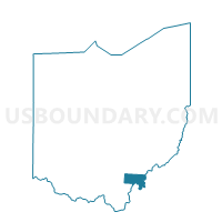
Outline

Summary
| Unique Area Identifier | 649985 |
| Name | SCIPIO Voting District |
| County | Meigs County |
| State | Ohio |
| Area (square miles) | 37.56 |
| Land Area (square miles) | 37.56 |
| Water Area (square miles) | 0.00 |
| % of Land Area | 100.00 |
| % of Water Area | 0.00 |
| Latitude of the Internal Point | 39.15223210 |
| Longtitude of the Internal Point | -82.13999010 |
Maps


Graphs
Select a template below for downloading or customizing gragh for SCIPIO Voting District, Meigs County, Ohio


Neighbors
Neighoring Voting District (by Name) Neighboring Voting District on the Map
- Voting District ALEXANDER EAST, Athens County, OH
- BEDFORD Voting District, Meigs County, OH
- COLUMBIA Voting District, Meigs County, OH
- EAST RUTLAND Voting District, Meigs County, OH
- LAUREL CLIFF Voting District, Meigs County, OH
- Voting District LEE TOWNSHIP, Athens County, OH
- Voting District LODI TOWNSHIP, Athens County, OH
- SALEM Voting District, Meigs County, OH
- WEST RUTLAND Voting District, Meigs County, OH
Top 10 Neighboring County Subdivision (by Population) Neighboring County Subdivision on the Map
- Salisbury township, Meigs County, OH (6,356)
- Alexander township, Athens County, OH (2,811)
- Lee township, Athens County, OH (2,729)
- Rutland township, Meigs County, OH (2,353)
- Lodi township, Athens County, OH (1,425)
- Bedford township, Meigs County, OH (1,355)
- Scipio township, Meigs County, OH (1,318)
- Columbia township, Meigs County, OH (1,189)
- Salem township, Meigs County, OH (1,051)
Top 10 Neighboring Unified School District (by Population) Neighboring Unified School District on the Map
Top 10 Neighboring State Legislative District Lower Chamber (by Population) Neighboring State Legislative District Lower Chamber on the Map
Top 10 Neighboring State Legislative District Upper Chamber (by Population) Neighboring State Legislative District Upper Chamber on the Map
Top 10 Neighboring 111th Congressional District (by Population) Neighboring 111th Congressional District on the Map
Top 10 Neighboring Census Tract (by Population) Neighboring Census Tract on the Map
- Census Tract 9738, Athens County, OH (4,867)
- Census Tract 9642, Meigs County, OH (4,808)
- Census Tract 9643, Meigs County, OH (4,808)
- Census Tract 9737, Athens County, OH (4,140)