


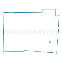
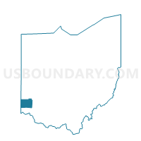
WEST CHESTER TWP WC43 Voting District, Butler County, Ohio
About
Outline

Summary
| Unique Area Identifier | 643100 |
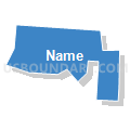
| Name | WEST CHESTER TWP WC43 Voting District |
| County | Butler County |
| State | Ohio |
| Area (square miles) | 0.22 |
| Land Area (square miles) | 0.22 |
| Water Area (square miles) | 0.00 |
| % of Land Area | 100.00 |
| % of Water Area | 0.00 |
| Latitude of the Internal Point | 39.36924660 |
| Longtitude of the Internal Point | -84.41406330 |
Maps

Graphs
Select a template below for downloading or customizing gragh for WEST CHESTER TWP WC43 Voting District, Butler County, Ohio


Neighbors
Neighoring Voting District (by Name) Neighboring Voting District on the Map
- LIBERTY TWP LIBERTY19 Voting District, Butler County, OH
- WEST CHESTER TWP WC16 Voting District, Butler County, OH
- WEST CHESTER TWP WC4 Voting District, Butler County, OH
- WEST CHESTER TWP WC48 Voting District, Butler County, OH