


GABBS PRECINCT 04, Nye County, Nevada
About
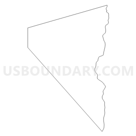
Outline
Summary
| Unique Area Identifier | 615436 |
| Name | GABBS PRECINCT 04 |
| County | Nye County |
| State | Nevada |
| Area (square miles) | 448.27 |
| Land Area (square miles) | 447.44 |
| Water Area (square miles) | 0.83 |
| % of Land Area | 99.81 |
| % of Water Area | 0.19 |
| Latitude of the Internal Point | 38.87568200 |
| Longtitude of the Internal Point | -117.94153760 |
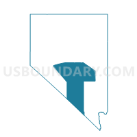
Maps


Graphs
Select a template below for downloading or customizing gragh for GABBS PRECINCT 04, Nye County, Nevada


Neighbors
Neighoring Voting District (by Name) Neighboring Voting District on the Map
- CHURCHILL PRECINCT 16, Churchill County, NV
- IONE PRECINCT 05, Nye County, NV
- MINA PRECINCT 9, Mineral County, NV
- Precinct No. 6 - Southern Lander County, Lander County, NV
Top 10 Neighboring County Subdivision (by Population) Neighboring County Subdivision on the Map
- Walker River CCD, Mineral County, NV (750)
- Austin CCD, Lander County, NV (528)
- Gabbs CCD, Nye County, NV (525)
- Mina CCD, Mineral County, NV (233)
- Dixie Valley CCD, Churchill County, NV (170)
Top 10 Neighboring Place (by Population) Neighboring Place on the Map
Top 10 Neighboring Unified School District (by Population) Neighboring Unified School District on the Map
- Nye County School District, NV (43,946)
- Churchill County School District, NV (24,877)
- Lander County School District, NV (5,775)
- Mineral County School District, NV (4,772)
Top 10 Neighboring State Legislative District Lower Chamber (by Population) Neighboring State Legislative District Lower Chamber on the Map
Top 10 Neighboring State Legislative District Upper Chamber (by Population) Neighboring State Legislative District Upper Chamber on the Map
Top 10 Neighboring 111th Congressional District (by Population) Neighboring 111th Congressional District on the Map
Top 10 Neighboring Census Tract (by Population) Neighboring Census Tract on the Map
- Census Tract 3, Lander County, NV (5,775)
- Census Tract 9501, Churchill County, NV (2,563)
- Census Tract 9601, Nye County, NV (2,330)
- Census Tract 9708, Mineral County, NV (1,337)